Martuni, Armenia
- For the village of the same name located on the northern side of Lake Sevan, see Martuni (village).
| Martuni Մարտունի | |
|---|---|
|
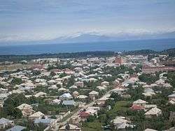
Martuni with the Lake Sevan in the background | |
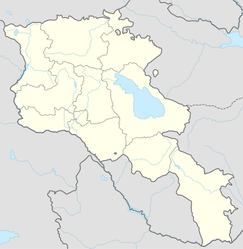 Martuni Մարտունի Location of Martuni in Armenia | |
| Coordinates: 40°08′24″N 45°18′23″E / 40.14000°N 45.30639°E | |
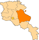
| Country Marz |
Gegharkunik |
| Founded | 1830 |
| Government | |
| • Mayor | Bagrat Harutyunyan |
| Area | |
| • City | 10 km2 (4 sq mi) |
| Elevation | 1,510 m (4,950 ft) |
| Population (2011 census) | |
| • Metro | 12,894 |
| Time zone | GMT+4 (UTC+4) |
| Sources: Population[1] | |
Coordinates: 40°08′24″N 45°18′23″E / 40.14000°N 45.30639°E
Martuni (Armenian: Մարտունի), is a town in the Gegharkunik Province of Armenia, located on the southern shores of Lake Sevan.
As of the 2011 census, the population of the town is 12,894.
During the medieval period, Martuni was known as Mets Kznut, but from 1830-1922 it was called Nerkin Gharanlugh and in 1926 it was changed to Martuni in honor of the first Soviet premier of Armenia, Aleksandr Myasnikyan, whose nom de guerre was "Martuni". Martuni was the former capital of Gegharkunik Province. Martuni has a church called Astvatsatsin church which was rebuilt in 1886. There is also an Iron Age fort excavated in 1997 by an Armenian-Italian team.
Economy
Martuni is home to the "Arev-1" bread factory founded in 1995, and the "Golden Lens" coffee processing plant founded in 1998.
International relations
Partnerships
Gallery
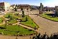 Martuni central square
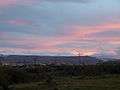 Martuni at dusk
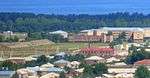 Martuni City Stadium