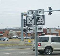
Missouri Route 152
| ||||
|---|---|---|---|---|
| Route information | ||||
| Length: | 16.875 mi[1] (27.158 km) | |||
| Major junctions | ||||
| West end: |
| |||
| East end: |
| |||
| Highway system | ||||
| ||||

Route 152 is a state highway in the northern Kansas City metropolitan area. It begins at Interstate 435 south of the Kansas City International Airport and ends at Route 291 in Liberty. The route is a limited access highway between its two junctions with I-435. It crosses I-29 five miles (8.0 km) south of the airport in Platte County and US 169 in Clay County.
The original route was called "Military Road" and connected the Liberty Arsenal with Fort Leavenworth. Military Road has been renamed Barry Road. Barry Road runs parallel to 152 on its south side on the west side and parallel to 152 on the north side in the eastern portions.[2]
In 2008, the Kansas City City Council approved a master plan for Kansas City International Airport that called for extensive improvements to the road so it could become a main thoroughfare to the proposed Central Terminal on the south side of the airport by 2025.[3]
Junction list
| County | Location | mi[1] | km | Destinations | Notes |
|---|---|---|---|---|---|
| Platte | Parkville | 0.000– 0.323 | 0.000– 0.520 | I-435 exit 24; continuation as Route N. | |
| Kansas City | 1.328 | 2.137 | West end of freeway. | ||
| 3.904 | 6.283 | Amity Avenue | |||
| 4.931 | 7.936 | Congress Avenue | Eastbound exit and westbound entrance only | ||
| 5.146– 5.784 | 8.282– 9.308 | ||||
| 5.906 | 9.505 | Ambassador Drive | Westbound exit and eastbound entrance only | ||
| 6.915 | 11.129 | Green Hills Road – Lake Waukomis | |||
| 8.566 | 13.786 | Platte Purchase Drive | |||
| Clay | 8.916– 9.674 | 14.349– 15.569 | |||
| 9.952 | 16.016 | North Oak Trafficway | |||
| 10.933 | 17.595 | Maplewoods Parkway | |||
| 12.292 | 19.782 | ||||
| 13.347 | 21.480 | Brighton Avenue | |||
| 13.727– 14.403 | 22.091– 23.179 | I-435 exits 49A-B; east end of freeway. | |||
| Liberty | 16.765– 16.875 | 26.981– 27.158 | I-35 exit 16. | ||
| Eastern terminus of Route 152 | |||||
| 1.000 mi = 1.609 km; 1.000 km = 0.621 mi | |||||
References
- 1 2 Missouri Department of Transportation (June 1, 2014). Flex Map Viewer (Map). Missouri Department of Transportation. Retrieved June 1, 2014.
- ↑ http://www.cityofplattewoods.org/city_history.htm
- ↑ KCI Studies - airportsites.net - Retrieved February 9, 2010