Monacia-d'Aullène
| Monacia-d'Aullène Munacia d'Auddé | |
|---|---|
|
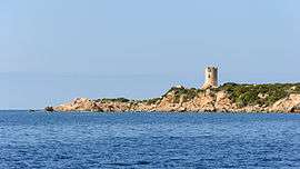
The Tower of Olmeto, a Genoese tower which is located in the commune | |
 Monacia-d'Aullène | |
|
Location within Corsica region 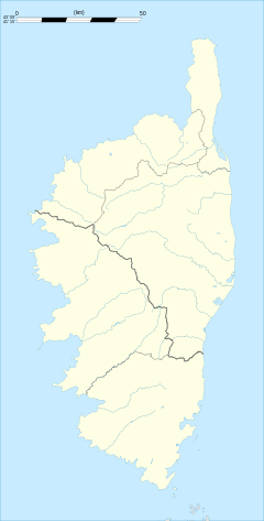 Monacia-d'Aullène | |
| Coordinates: 41°30′49″N 9°00′45″E / 41.5136°N 9.0125°ECoordinates: 41°30′49″N 9°00′45″E / 41.5136°N 9.0125°E | |
| Country | France |
| Region | Corsica |
| Department | Corse-du-Sud |
| Arrondissement | Sartène |
| Canton | Figari |
| Government | |
| • Mayor (2008–2014) | Marc Eugène Luciani |
| Area1 | 40 km2 (20 sq mi) |
| Population (2008)2 | 478 |
| • Density | 12/km2 (31/sq mi) |
| Time zone | CET (UTC+1) |
| • Summer (DST) | CEST (UTC+2) |
| INSEE/Postal code | 2A163 / 20171 |
| Elevation |
0–1,188 m (0–3,898 ft) (avg. 120 m or 390 ft) |
|
1 French Land Register data, which excludes lakes, ponds, glaciers > 1 km² (0.386 sq mi or 247 acres) and river estuaries. 2 Population without double counting: residents of multiple communes (e.g., students and military personnel) only counted once. | |
Monacia-d'Aullène is a commune in the Corse-du-Sud department of France on the island of Corsica.
It shares the canton of Figari with the commune of Figari, Sotta and Pianotolli-Caldarello.
Geography
Monacia-d'Aullène is 14 kilometres (9 mi) west northwest of Figari. It was created in 1864 by dividing Aullène. To the north is the 1,292-metre (4,239 ft) high Mount Cagna, known for its balanced granite boulders named the "Man of Cagna", where the isolated hamlet of Giannucio is located. To the southwest, the commune has an opening to the coast between Point Roccapino to the northwest and the Cala di Furnellu. The latter is preceded by Caniscione Point, on which is the Genoese Tower of Olmeto.[1]
Population
| Historical population | ||
|---|---|---|
| Year | Pop. | ±% |
| 1962 | 308 | — |
| 1968 | 325 | +5.5% |
| 1975 | 353 | +8.6% |
| 1982 | 421 | +19.3% |
| 1990 | 412 | −2.1% |
| 1999 | 396 | −3.9% |
| 2005 | 476 | +20.2% |
| 2008 | 478 | +0.4% |
See also
References
- ↑ "France, le trésor des régions: Département: Corse-du-Sud" (in French). Retrieved 2008-05-06..
| Wikimedia Commons has media related to Monacia-d'Aullène. |