Mount Kita
| Mount Kita | |
|---|---|
| 北岳 | |
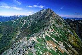 Mount Kita viewed from Mount Nakashirane | |
| Highest point | |
| Elevation | 3,193 m (10,476 ft) [1] |
| Prominence | 2,239 m (7,346 ft) [2] |
| Listing |
100 Famous Japanese Mountains Ultra |
| Coordinates | 35°40′27″N 138°14′12″E / 35.67417°N 138.23667°ECoordinates: 35°40′27″N 138°14′12″E / 35.67417°N 138.23667°E [2] |
| Naming | |
| Translation | northern peak (Japanese) |
| Pronunciation | [kitadake] |
| Geography | |
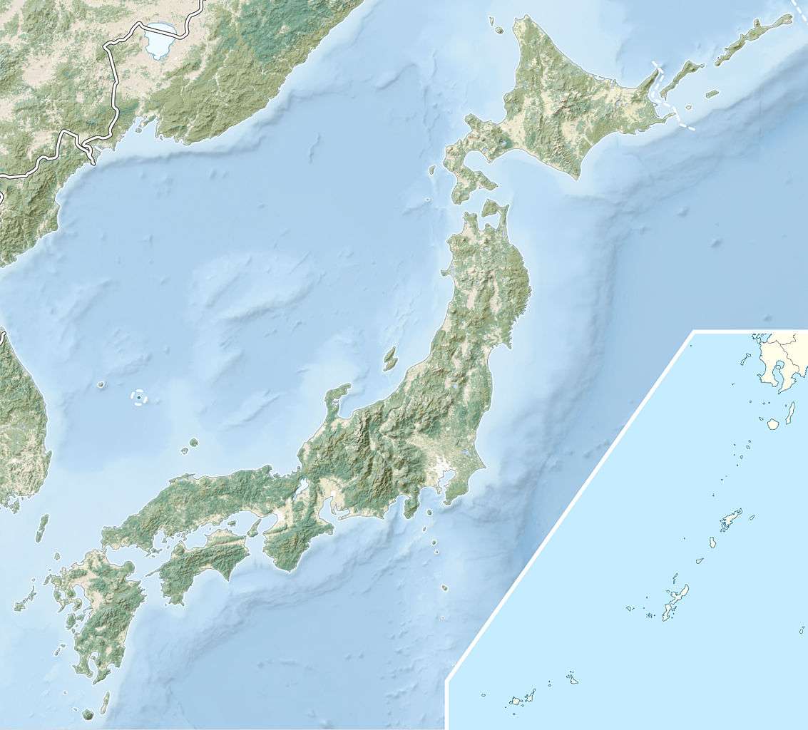 Mount Kita Japan | |
| Location | Minami-Alps, Yamanashi Prefecture, Japan |
| Parent range | Akaishi Mountains |
| Topo map | Geographical Survey Institute (国土地理院 Kokudochiriin) 25000:1 仙丈ヶ岳, 50000:1 市野瀬 |
| Climbing | |
| Easiest route | Hike |
Mount Kita (北岳 Kita-dake) is a mountain of the Akaishi Mountains−"Southern Alps" (南アルプス Minami-Arupusu), in Yamanashi Prefecture, Japan.
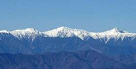
It is the second tallest mountain in Japan, after Mount Fuji, and is known as "the Leader of the Southern Alps".[3] It is included in the 100 Famous Japanese Mountains. It is located in Minami Alps National Park, near the city of Minami-Alps.
Geography
The Kitadake Buttress (北岳バットレス Kita-dake Battoresu) is a 600 m (1,969 ft) tall rock face on the eastern side of the mountain.
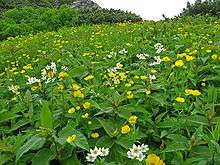
Alpine plants grow abundantly, especially on the mountain's southeastern slope along the route to Mount Nakashirane (中白峰山 Nakashirane-san) and along the Kusasuberi (草すべり kusasuberi) and Migimata (右俣 migimata) courses along Shiraneo Pond (白根御池 Shiraneo-ike) on the mountain's northern side. Large clusters of plants can be seen from huts near the top. The species Callianthemum hondoense (キタダケソウ kitadakesō) is endemic to this mountain.
Origin of the name
The main mountains of the Akaishi Mountains are Mount Kita, Mount Aino and Mount Nōtori. The three mountains together are called "Shirane-sanzan" (白根三山), which means "Three White Summits". The name Mount Kita literally means "northern mountain," referring to its being the northernmost of the three mountains.
Climbing
The mountain area around Mount Kita is one of the most popular in Japan, reputedly second only to the Mount Yari and Mount Hotaka area. Access points for climbing are at Hirogawara (広河原) to the east and Ryōmata (両俣) to the west; however, most people choose to climb from Hirogawara, where facilities are better. Two mountain huts near the top provide accommodation for up to 150 people and there are campground facilities nearby.
There are three main access routes to the summit of Mount Kita. The first starts out in Hirogawara and follows the Ōkanbazawa River (大樺沢 Ōkanbazawa-gawa) up through the Daisekkei Valley (大雪渓 Daisekkei). Another route leaves the river valley earlier and emerges from the forest at Shiraneoike-Kusasuberi. A third trail runs from Ryōmata at the trail head near Nakashiranezawa (中白根沢 nakashiranezawa) to the summit of the mountain.
From the summit, a trail runs along the ridge via Nakashiranesan to Mount Aino, Mount Nishinōtori (西農鳥岳 Nishinōtori-dake), Mount Nōtori, and continues further south. An alternate route, (Ikeyama-tsurione (池山吊尾根)), has been built, which connects the viewing platform at Washinosumiyama (鷲住山) to the summit, via the head at Bōkonzawa (ボーコン沢). This approach is not very popular, except in winter, when the path gets greater use. Kitadake Buttress is a classic route for free climbing in Japan.
The main mountain huts in the vicinity of Mount Kita are the Kitadakekatano Hut (北岳肩ノ小屋 Kitadakekata no Koya), the Kitadake Mountain Cottage (北岳山荘 Kitadake Sansō), the Shiraneoike Hut (白根御池小屋 Shiraneoike Koya) and the Ryōmata Hut (両俣小屋 Ryōmata Koya).
Images

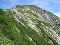 Kitadake Buttress
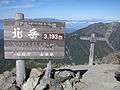 Two signboards indicating the new and old elevation
 View from the summit 1
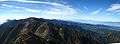 View from the summit 2
 Kitadakesou (Callianthemum hondoense)
References
- ↑ Geographical Survey Institute map 25000:1 仙丈ヶ岳 accessed online 8 April 2008.
- 1 2 "Japan Ultra-Prominences". Peaklist.org. Retrieved 2015-01-01.
- ↑ Mount Kita. (Japanese) Minami Alps Net. Accessed July 1, 2008.
See also
- List of mountains in Japan
- 100 Famous Japanese Mountains
- Three-thousanders (in Japan)
- Akaishi Mountains
- List of Ultras of Japan
External links
- Topographic map (1:25,000)
| Wikimedia Commons has media related to Mount Kita. |