Mount Tomuraushi (Daisetsuzan)
This article refers to the volcano in the central Hokkaidō. For the other mountains, see Mount Tomuraushi (disambiguation).
| Mount Tomuraushi | |
|---|---|
| トムラウシ山 | |
 View of Mount Tomuraushi from Mount Chūbetsu (August 2006) | |
| Highest point | |
| Elevation | 2,141.2 m (7,025 ft) [1] |
| Listing |
List of mountains and hills of Japan by height 100 Famous Japanese Mountains |
| Coordinates | 43°31′38″N 142°50′55″E / 43.52722°N 142.84861°ECoordinates: 43°31′38″N 142°50′55″E / 43.52722°N 142.84861°E |
| Geography | |
| Location | Hokkaidō, Japan |
| Parent range | Tomuraushi Volcanic Group |
| Topo map | Geographical Survey Institute (国土地理院 Kokudochiriin) 25000:1 トムラウシ山 50000:1 旭岳 |
| Geology | |
| Age of rock | Quaternary |
| Mountain type | Volcanic |
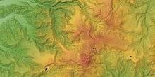
Tomuraushi-Chubetsu Volcano Group
Mount Tomuraushi (トムラウシ山 Tomuraushi-san) is located in the Daisetsuzan National Park, Hokkaidō, Japan. It is one of the 100 famous mountains in Japan.
Geology
The peak of Mount Tomuraushi consists of mainly non-alkalai mafic rock from the Pleistocene to the Holocene.[2]
History
On July 16, 2009, eight members of an adventure tour group on a 4-day hiking trek died of exposure on Mount Tomuraushi. Five others from the group were helicoptered to safety. On the same day, another climber died on nearby Mount Biei. The next day a lone hiker was found dead on Mount Tomuraushi.[3]
References
- ↑ 地図閲覧サービス 2万5千分1地形図名: トムラウシ山(旭川) (in Japanese). Geospatial Information Authority of Japan. Retrieved 20 September 2010.
- ↑ "Hokkaido". Seamless digital geological map of Japan 1: 200,000. Geological Survey of Japan, AIST. Retrieved 20 September 2010.
- ↑ "10 climbers perish in Hokkaido". The Japan Times Online. The Japan Times. 2009-07-18. Retrieved 17 December 2009.
External links
![]() Media related to Mount Tomuraushi at Wikimedia Commons
Media related to Mount Tomuraushi at Wikimedia Commons
- Tomuraushi-Chubetsu Volcano Group - Geological Survey of Japan
This article is issued from Wikipedia - version of the 3/27/2016. The text is available under the Creative Commons Attribution/Share Alike but additional terms may apply for the media files.