New Baltimore, Ohio
For the unincorporated community in Stark County, see New Baltimore, Stark County, Ohio.
| New Baltimore, Ohio | |
|---|---|
| Census-designated place | |
 Location in Hamilton County and the state of Ohio. | |
| Coordinates: 39°15′53″N 84°40′2″W / 39.26472°N 84.66722°WCoordinates: 39°15′53″N 84°40′2″W / 39.26472°N 84.66722°W | |
| Country | United States |
| State | Ohio |
| County | Hamilton |
| Area | |
| • Total | 1.4 sq mi (3.6 km2) |
| • Land | 1.4 sq mi (3.6 km2) |
| • Water | 0 sq mi (0 km2) |
| Elevation[1] | 550 ft (170 m) |
| Population (2010) | |
| • Total | 661 |
| • Density | 480/sq mi (180/km2) |
| Time zone | Eastern (EST) (UTC-5) |
| • Summer (DST) | EDT (UTC-4) |
| ZIP code | 45030 |
| FIPS code | 39-54082[2] |
| GNIS feature ID | 1065109[1] |
New Baltimore is a census-designated place (CDP) in Crosby Township, Hamilton County, Ohio. The population was 661 in the 2010 census.[3]
The village, about four miles east of New Haven. was laid out in 1819 by mill owner Samuel Pottinger.[4] In July 1863, Morgan's Raiders of the Confederate Army used a ford at New Baltimore to cross the Miami River.
Geography
New Baltimore is situated at 39°15′53″N 84°40′2″W / 39.26472°N 84.66722°W,[5] 17 miles (27 km) northwest of downtown Cincinnati. It lies along the north bank of the Great Miami River.
The CDP has a total area of 1.4 square miles (3.6 km2), all land.[3]
References
- 1 2 "US Board on Geographic Names". United States Geological Survey. 2007-10-25. Retrieved 2008-01-31.
- ↑ "American FactFinder". United States Census Bureau. Retrieved 2008-01-31.
- 1 2 "Geographic Identifiers: 2010 Demographic Profile Data (G001): New Baltimore CDP, Ohio". U.S. Census Bureau, American Factfinder. Retrieved November 14, 2012.
- ↑ Nelson, S. B. (1894). History of Cincinnati and Hamilton County, Ohio: Their Past and Present, Including...biographies and Portraits of Pioneers and Representative Citizens, etc., Volume 1. p. 397. Retrieved 11 December 2013.
- ↑ "US Gazetteer files: 2010, 2000, and 1990". United States Census Bureau. 2011-02-12. Retrieved 2011-04-23.
Municipalities and communities of Hamilton County, Ohio, United States | ||
|---|---|---|
| Cities | 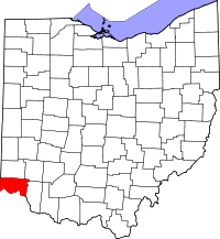 | |
| Villages | ||
| Townships | ||
| CDPs |
| |
| Other unincorporated communities | ||
| Footnotes | ‡This populated place also has portions in an adjacent county or counties | |
This article is issued from Wikipedia - version of the 9/25/2016. The text is available under the Creative Commons Attribution/Share Alike but additional terms may apply for the media files.