Oranjezicht
| Oranjezicht | |
|---|---|
|
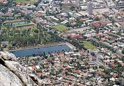
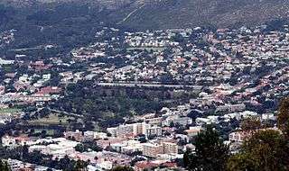
Part of Oranjezicht from the summit of Table Mountain. Molteno Dam and De Waal Park centre left. | |
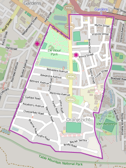 Street map of Oranjezicht | |
 Oranjezicht  Oranjezicht  Oranjezicht
| |
|
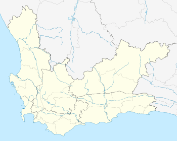
Location within Cape Town 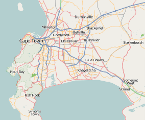 Oranjezicht | |
| Coordinates: 33°56′30″S 18°24′50″E / 33.94167°S 18.41389°ECoordinates: 33°56′30″S 18°24′50″E / 33.94167°S 18.41389°E | |
| Country | South Africa |
| Province | Western Cape |
| Municipality | City of Cape Town |
| Main Place | Cape Town |
| Government | |
| • Councillor | Vivienne Walker (DA) |
| Area[1] | |
| • Total | 1.13 km2 (0.44 sq mi) |
| Population (2011)[1] | |
| • Total | 3,580 |
| • Density | 3,200/km2 (8,200/sq mi) |
| Racial makeup (2011)[1] | |
| • Black African | 13.3% |
| • Coloured | 5.2% |
| • Indian/Asian | 2.2% |
| • White | 74.6% |
| • Other | 4.7% |
| First languages (2011)[1] | |
| • English | 65.6% |
| • Afrikaans | 22.6% |
| • Xhosa | 1.7% |
| • Other | 10.2% |
| Postal code (street) | 8001 |
Oranjezicht (Dutch: orange view) is a suburb in Cape Town, South Africa, built on the site of the old Oranjezicht farm, which used to stretch at least as far as the Mount Nelson Hotel and supplied the Castle of Good Hope with fresh produce
In 1708, Nicolaus Laubscher (1651–1721), who had immigrated in the 1670s from the Swiss canton of Fribourg, bought a property on the slopes of Table Mountain that he called “Oranjezicht” because of the good view from there of the Oranje (Orange) bastion of the Castle.[2] Subsequent to his death, the farm was evidently acquired by Pieter van Breda (1696–1759), who arrived at the Cape in 1719 from the Netherlands.[3] “Oranjezicht” was a farm for the next two centuries.
Some of the buildings of the farm as well as the old slave bell are still at the location where the farm once stood. The farmhouse was on the property directly to the east of what is now a public park and playground. It was torn down in the 1960s to make way for a bowling green, which was later replaced by the Oranjezicht City Farm, a community farm, in 2013.
The Molteno Dam was built in 1877, to provide water for Cape Town by storing natural spring water from Table Mountain. At the time it was located on the mountain slopes above the infant city, but the city grew around it and it is now in the middle of the Oranjezicht suburbs. It is still in operation today.[4]
St. Cyprian's School and the Booth Memorial Hospital are located in the suburb.
References
- 1 2 3 4 "Sub Place Oranjezicht". Census 2011.
- ↑ Adolphe Linder, The Swiss at the Cape of Good Hope, 1652–1971 (Basel: Basel Afrika Bibliographien, 1997), pp. 64–69.
- ↑ Pieter van Breda's dates from C. C. de Villiers, Geslagsregisters van die ou Kaapse families / Genealogies of Old South African Families, rev. ed. by C. Pama, 3 vols. (Cape Town: Balkema, 1966), 1: 96.
- ↑ Heikki Vuorinen, “Environmental History of Water” (IWA Publishing, 2007), pp. 170–171.
.svg.png)