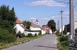
Radkovice u Hrotovic
| Radkovice u Hrotovic | ||
|---|---|---|
| Municipality | ||
 | ||
| ||
 Radkovice u Hrotovic | ||
| Coordinates: 49°4′15″N 15°59′4″E / 49.07083°N 15.98444°ECoordinates: 49°4′15″N 15°59′4″E / 49.07083°N 15.98444°E | ||
| Country |
| |
| Region | Vysočina | |
| District | Třebíč | |
| Area | ||
| • Total | 15.28 km2 (5.90 sq mi) | |
| Elevation | 448 m (1,470 ft) | |
| Population (2006) | ||
| • Total | 348 | |
| • Density | 23/km2 (59/sq mi) | |
| Postal code | 675 59 | |
| Website | http://www.hrotovicko.cz/radkovice/ | |

Radkovice u Hrotovic is a village and municipality (obec) in Třebíč District in the Vysočina Region of the Czech Republic.
The municipality covers an area of 15.28 square kilometres (5.90 sq mi), and has a population of 348 (as at 3 July 2006).
Radkovice u Hrotovic lies approximately 19 kilometres (12 mi) south-east of Třebíč, 47 km (29 mi) south-east of Jihlava, and 160 km (99 mi) south-east of Prague.
References
| Wikimedia Commons has media related to Radkovice u Hrotovic. |
This article is issued from Wikipedia - version of the 4/7/2016. The text is available under the Creative Commons Attribution/Share Alike but additional terms may apply for the media files.