Rock County, Nebraska
| Rock County, Nebraska | |
|---|---|
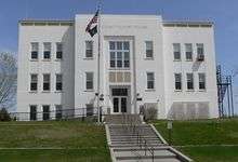 Rock County Courthouse in Bassett | |
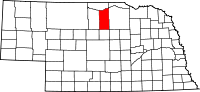 Location in the U.S. state of Nebraska | |
 Nebraska's location in the U.S. | |
| Founded | 1888 |
| Seat | Bassett |
| Largest city | Bassett |
| Area | |
| • Total | 1,012 sq mi (2,621 km2) |
| • Land | 1,008 sq mi (2,611 km2) |
| • Water | 3.4 sq mi (9 km2), 0.3% |
| Population | |
| • (2010) | 1,526 |
| • Density | 1.5/sq mi (1/km²) |
| Congressional district | 3rd |
| Time zone | Central: UTC-6/-5 |
Rock County is a county located in the U.S. state of Nebraska. As of the 2010 census, the population was 1,526.[1] Its county seat is Bassett.[2]
In the Nebraska license plate system, Rock County is represented by the prefix 81 (it had the 81st-largest number of vehicles registered in the county when the license plate system was established in 1922).
Geography
According to the U.S. Census Bureau, the county has a total area of 1,012 square miles (2,620 km2), of which 1,008 square miles (2,610 km2) is land and 3.4 square miles (8.8 km2) (0.3%) is water.[3]
Rock County is located in Nebraska's Outback region.[4]
Major highways
Adjacent counties
- Keya Paha County - north
- Boyd County - northeast
- Holt County - east
- Loup County - south
- Brown County - west
National protected areas
Demographics
| Historical population | |||
|---|---|---|---|
| Census | Pop. | %± | |
| 1890 | 3,083 | — | |
| 1900 | 2,809 | −8.9% | |
| 1910 | 3,627 | 29.1% | |
| 1920 | 3,703 | 2.1% | |
| 1930 | 3,366 | −9.1% | |
| 1940 | 3,977 | 18.2% | |
| 1950 | 3,026 | −23.9% | |
| 1960 | 2,554 | −15.6% | |
| 1970 | 2,231 | −12.6% | |
| 1980 | 2,383 | 6.8% | |
| 1990 | 2,019 | −15.3% | |
| 2000 | 1,756 | −13.0% | |
| 2010 | 1,526 | −13.1% | |
| Est. 2015 | 1,381 | [5] | −9.5% |
| U.S. Decennial Census[6] 1790-1960[7] 1900-1990[8] 1990-2000[9] 2010-2013[1] | |||
As of the census[10] of 2000, there were 1,756 people, 763 households, and 501 families residing in the county. The population density was 2 people per square mile (1/km²). There were 935 housing units at an average density of 1 per square mile (0/km²). The racial makeup of the county was 99.03% White, 0.46% Native American, 0.17% Asian, 0.06% from other races, and 0.28% from two or more races. 0.51% of the population were Hispanic or Latino of any race. 33.1% were of German, 12.7% American, 10.5% Irish and 8.4% English ancestry according to Census 2000
There were 763 households out of which 26.90% had children under the age of 18 living with them, 57.40% were married couples living together, 6.40% had a female householder with no husband present, and 34.30% were non-families. 31.30% of all households were made up of individuals and 15.90% had someone living alone who was 65 years of age or older. The average household size was 2.26 and the average family size was 2.84.
In the county the population was spread out with 23.00% under the age of 18, 6.50% from 18 to 24, 23.60% from 25 to 44, 24.60% from 45 to 64, and 22.30% who were 65 years of age or older. The median age was 44 years. For every 100 females there were 92.30 males. For every 100 females age 18 and over, there were 89.90 males.
The median income for a household in the county was $25,795, and the median income for a family was $29,917. Males had a median income of $24,167 versus $16,490 for females. The per capita income for the county was $14,350. About 17.70% of families and 21.80% of the population were below the poverty line, including 36.30% of those under age 18 and 14.00% of those age 65 or over.
Education
Rock County Public Schools operates public schools.
Communities
See also
References
- 1 2 "State & County QuickFacts". United States Census Bureau. Retrieved September 22, 2013.
- ↑ "Find a County". National Association of Counties. Retrieved 2011-06-07.
- ↑ "2010 Census Gazetteer Files". United States Census Bureau. August 22, 2012. Retrieved December 11, 2014.
- ↑ "About", North Central RC&D. Retrieved 9/17/07
- ↑ "County Totals Dataset: Population, Population Change and Estimated Components of Population Change: April 1, 2010 to July 1, 2015". Retrieved July 2, 2016.
- ↑ "U.S. Decennial Census". United States Census Bureau. Retrieved December 11, 2014.
- ↑ "Historical Census Browser". University of Virginia Library. Retrieved December 11, 2014.
- ↑ "Population of Counties by Decennial Census: 1900 to 1990". United States Census Bureau. Retrieved December 11, 2014.
- ↑ "Census 2000 PHC-T-4. Ranking Tables for Counties: 1990 and 2000" (PDF). United States Census Bureau. Retrieved December 11, 2014.
- ↑ "American FactFinder". United States Census Bureau. Retrieved 2008-01-31.
 |
Keya Paha County | Boyd County | | |
| Brown County | |
Holt County | ||
| ||||
| | ||||
| Loup County |
Municipalities and communities of Rock County, Nebraska, United States | ||
|---|---|---|
| City | ||
| Village | ||
| Unincorporated communities | ||
Coordinates: 42°25′N 99°27′W / 42.42°N 99.45°W