Wheeler County, Nebraska
| Wheeler County, Nebraska | |
|---|---|
_from_NW.JPG) Wheeler County Courthouse in Bartlett | |
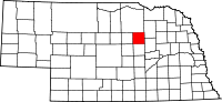 Location in the U.S. state of Nebraska | |
 Nebraska's location in the U.S. | |
| Founded | April 11, 1881 |
| Seat | Bartlett |
| Largest village | Bartlett |
| Area | |
| • Total | 576 sq mi (1,492 km2) |
| • Land | 575 sq mi (1,489 km2) |
| • Water | 0.4 sq mi (1 km2), 0.07% |
| Population | |
| • (2010) | 818 |
| • Density | 1.4/sq mi (1/km²) |
| Congressional district | 3rd |
| Time zone | Central: UTC-6/-5 |
| Website |
www |
Wheeler County is a county in the U.S. state of Nebraska. As of the 2010 census, the population was 818.[1] Its county seat is Bartlett.[2] The county was formed in 1877 and organized in 1881.[3][4][5] It was named after Major Daniel H. Wheeler.
In the Nebraska license plate system, Wheeler County is represented by the prefix 84 (it had the eighty-fourth-largest number of vehicles registered in the county when the license plate system was established in 1922).
Geography
According to the U.S. Census Bureau, the county has an area of 576 square miles (1,490 km2), of which 575 square miles (1,490 km2) is land and 0.4 square miles (1.0 km2) (0.07%) is water.[6]
Major highways
Adjacent counties
- Antelope County (northeast)
- Boone County (southeast)
- Greeley County (south)
- Garfield County (west)
- Holt County (north)
Demographics
| Historical population | |||
|---|---|---|---|
| Census | Pop. | %± | |
| 1880 | 644 | — | |
| 1890 | 1,683 | 161.3% | |
| 1900 | 1,362 | −19.1% | |
| 1910 | 2,292 | 68.3% | |
| 1920 | 2,531 | 10.4% | |
| 1930 | 2,335 | −7.7% | |
| 1940 | 2,170 | −7.1% | |
| 1950 | 1,526 | −29.7% | |
| 1960 | 1,297 | −15.0% | |
| 1970 | 1,051 | −19.0% | |
| 1980 | 1,060 | 0.9% | |
| 1990 | 948 | −10.6% | |
| 2000 | 886 | −6.5% | |
| 2010 | 818 | −7.7% | |
| Est. 2015 | 750 | [7] | −8.3% |
| U.S. Decennial Census[8] 1790-1960[9] 1900-1990[10] 1990-2000[11] 2010-2013[1] | |||
As of the census[12] of 2000, there were 886 people, 352 households, and 243 families residing in the county. The population density was 2 people per square mile (1/km²). There were 561 housing units at an average density of 1 per square mile (0/km²). The racial makeup of the county was 99.10% White, 0.23% Native American, 0.56% from other races, and 0.11% from two or more races. 0.56% of the population were Hispanic or Latino of any race. 47.4% were of German, 9.4% Irish, 7.8% English, 7.2% Swedish and 7.0% American ancestry according to Census 2000.
There were 352 households out of which 31.80% had children under the age of 18 living with them, 62.80% were married couples living together, 3.10% had a female householder with no husband present, and 30.70% were non-families. 29.00% of all households were made up of individuals and 14.80% had someone living alone who was 65 years of age or older. The average household size was 2.52 and the average family size was 3.10.
In the county the population was spread out with 29.10% under the age of 18, 6.40% from 18 to 24, 21.90% from 25 to 44, 25.70% from 45 to 64, and 16.80% who were 65 years of age or older. The median age was 40 years. For every 100 females there were 96.00 males. For every 100 females age 18 and over, there were 100.00 males.
The median income for a household in the county was $26,771, and the median income for a family was $33,750. Males had a median income of $21,563 versus $17,083 for females. The per capita income for the county was $14,355. About 15.40% of families and 20.90% of the population were below the poverty line, including 27.80% of those under age 18 and 16.70% of those age 65 or over.
Communities
- Bartlett (county seat)
- Cumminsville
- Ericson
See also
References
- 1 2 "State & County QuickFacts". United States Census Bureau. Retrieved September 22, 2013.
- ↑ "Find a County". National Association of Counties. Retrieved 2011-06-07.
- ↑ Fitzpatrick, Lilian Linder (1925). Nebraska Place-Names. Lincoln: University of Nebraska Studies in Language, Literature, and Criticism. p. 145. Retrieved December 17, 2014.
- ↑ Andreas, A. T. (1882). "Andreas' History of the State of Nebraska". The Kansas Collection. Retrieved December 17, 2014.
- ↑ "Wheeler County". Nebraska Association of County Officials. Retrieved December 17, 2014.
- ↑ "2010 Census Gazetteer Files". United States Census Bureau. August 22, 2012. Retrieved December 12, 2014.
- ↑ "County Totals Dataset: Population, Population Change and Estimated Components of Population Change: April 1, 2010 to July 1, 2015". Retrieved July 2, 2016.
- ↑ "U.S. Decennial Census". United States Census Bureau. Retrieved December 12, 2014.
- ↑ "Historical Census Browser". University of Virginia Library. Retrieved December 12, 2014.
- ↑ "Population of Counties by Decennial Census: 1900 to 1990". United States Census Bureau. Retrieved December 12, 2014.
- ↑ "Census 2000 PHC-T-4. Ranking Tables for Counties: 1990 and 2000" (PDF). United States Census Bureau. Retrieved December 12, 2014.
- ↑ "American FactFinder". United States Census Bureau. Retrieved 2008-01-31.
 |
Holt County | Antelope County | | |
| Garfield County | |
|||
| ||||
| | ||||
| Greeley County | Boone County |
Municipalities and communities of Wheeler County, Nebraska, United States | ||
|---|---|---|
| Villages | ||
| Unincorporated community | ||
| Ghost towns | ||
Coordinates: 41°55′N 98°32′W / 41.92°N 98.53°W