Roger Mills County, Oklahoma
| Roger Mills County, Oklahoma | |
|---|---|
 | |
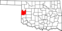 Location in the U.S. state of Oklahoma | |
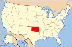 Oklahoma's location in the U.S. | |
| Founded | 1891 |
| Named for | Roger Q. Mills |
| Seat | Cheyenne |
| Largest town | Cheyenne |
| Area | |
| • Total | 1,146 sq mi (2,968 km2) |
| • Land | 1,141 sq mi (2,955 km2) |
| • Water | 5.3 sq mi (14 km2), 0.40% |
| Population (est.) | |
| • (2013) | 3,743 |
| • Density | 3.2/sq mi (1/km²) |
| Congressional district | 3rd |
| Time zone | Central: UTC-6/-5 |
| Website |
www |
Roger Mills County is a county located in the western part of the U.S. state of Oklahoma. As of the 2010 census, the population was 3,647,[1] making it the third-least populous county in Oklahoma. Its county seat is Cheyenne.[2] The county was created in 1891.[3]
Roger Mills county is located above the petroleum-rich Panhandle-Hugoton Field, making it one of the leading sources of oil, natural gas and helium. The county also overlies part of the Ogallala Aquifer.[4]
History
Roger Mills County takes its name from Roger Q. Mills, a senator from Texas.[4][5] The town of Cheyenne in Roger Mills County is the location of the Battle of Washita River (also called Battle of the Washita; Washita Battlefield and the Washita Massacre), where George Armstrong Custer’s 7th U.S. Cavalry attacked Chief Black Kettle’s Cheyenne village on the Washita River on November 26, 1868.[6]
The area covered by Roger Mills County had been part of the Cheyenne Arapaho reservation until after Oklahoma Territory was created and County E was formed. County E was renamed Day County. Day County was abolished and Roger Mills County was created at statehood on November 16, 1907. The county's western boundary with Texas was moved eastward 3,800 feet (1,200 m) when the Supreme Court ruled that the 100th Meridian was farther east than originally supposed.[4]
During the 1970s Roger Mills County and the surrounding area was the site of natural gas and oil development in the Panhandle-Hugoton field, the largest-volume gas field in the United States, and the world’s largest known source of helium. Between 1973 and 1993 the field produced over 8-trillion cubic feet (230,000,000 m³) of gas.
Geography
According to the U.S. Census Bureau, the county has a total area of 1,146 square miles (2,970 km2), of which 1,141 square miles (2,960 km2) is land and 5.3 square miles (14 km2) (0.5%) is water.[7] The Canadian River forms the northern border of the county.[4] The Washita River passes by Cheyenne and Strong City as it crosses the county from west to east. The historically-significant Antelope Hills lie in the northeastern part of the county.
Major Highways
Adjacent counties
- Ellis County (north)
- Dewey County (northeast)
- Custer County (east)
- Beckham County (south)
- Wheeler County, Texas (southwest)
- Hemphill County, Texas (northwest)
National protected areas
Demographics
| Historical population | |||
|---|---|---|---|
| Census | Pop. | %± | |
| 1900 | 6,190 | — | |
| 1910 | 12,861 | 107.8% | |
| 1920 | 10,638 | −17.3% | |
| 1930 | 14,744 | 38.6% | |
| 1940 | 10,736 | −27.2% | |
| 1950 | 7,395 | −31.1% | |
| 1960 | 5,090 | −31.2% | |
| 1970 | 4,452 | −12.5% | |
| 1980 | 4,799 | 7.8% | |
| 1990 | 4,147 | −13.6% | |
| 2000 | 3,436 | −17.1% | |
| 2010 | 3,647 | 6.1% | |
| Est. 2015 | 3,788 | [8] | 3.9% |
| U.S. Decennial Census[9] 1790-1960[10] 1900-1990[11] 1990-2000[12] 2010-2013[1] | |||
As of the census[13] of 2000, there were 3,436 people, 1,428 households, and 988 families residing in the county. The population density was 1/km² (3/mi²). There were 1,749 housing units at an average density of 1/km² (2/mi²). The racial makeup of the county was 91.76% White, 0.29% Black or African American, 5.47% Native American, 0.09% Asian, 0.52% from other races, and 1.86% from two or more races. 2.65% of the population were Hispanic or Latino of any race.
There were 1,428 households out of which 29.40% had children under the age of 18 living with them, 58.80% were married couples living together, 6.80% had a female householder with no husband present, and 30.80% were non-families. 28.60% of all households were made up of individuals and 16.90% had someone living alone who was 65 years of age or older. The average household size was 2.38 and the average family size was 2.91.
In the county, the population was spread out with 23.80% under the age of 18, 6.70% from 18 to 24, 24.70% from 25 to 44, 26.00% from 45 to 64, and 18.70% who were 65 years of age or older. The median age was 42 years. For every 100 females there were 100.50 males. For every 100 females age 18 and over, there were 96.90 males.
The median income for a household in the county was $30,078, and the median income for a family was $35,921. Males had a median income of $22,224 versus $19,821 for females. The per capita income for the county was $16,821. About 11.50% of families and 16.30% of the population were below the poverty line, including 20.40% of those under age 18 and 10.40% of those age 65 or over.
Economy
The county economy has depended on agriculture, which has benefitted from the fact that it lies above the Ogallala Aquifer. Principal crops have included Kaffir corn, broomcorn, wheat, cotton, corn, and alfalfa. Farms have been consolidating throughout the period since the Great Depression. In 1930, there were 2,353 farms, averaging 278.3 acres each. By 2000, there were 680 farms, averaging 1,015.54 acres each.[4]
Petroleum and natural gas production has become an important contributor since discovery of the Panhandle-Hugoton Field.[4]
Politics
| Voter Registration and Party Enrollment as of January 15, 2016[14] | |||||
|---|---|---|---|---|---|
| Party | Number of Voters | Percentage | |||
| Democratic | 1,299 | 56.87% | |||
| Republican | 827 | 36.21% | |||
| Unaffiliated | 158 | 6.92% | |||
| Total | 2,284 | 100% | |||
| Year | Republican | Democrat |
|---|---|---|
| 2012 | 83.75% 1,402 | 16.25% 272 |
| 2008 | 83.96% 1,502 | 16.04% 287 |
| 2004 | 78.42% 1,388 | 21.58% 382 |
| 2000 | 73.15% 1,234 | 26.14% 441 |
Communities
- Berlin
- Cheyenne (county seat)
- Crawford
- Durham
- Grimes
- Hammon
- Reydon
- Roll
- Strong City
- Sweetwater
See also
References
- 1 2 "State & County QuickFacts". United States Census Bureau. Retrieved November 12, 2013.
- ↑ "Find a County". National Association of Counties. Retrieved 2011-06-07.
- ↑ "Oklahoma: Individual County Chronologies". Oklahoma Atlas of Historical County Boundaries. The Newberry Library. Retrieved February 24, 2015.
- 1 2 3 4 5 6 Wilson, Linda D. "Roger Mills County,' Encyclopedia of Oklahoma History and Culture, Oklahoma Historical Society, 2009. Accessed April 5, 2015.
- ↑ "Origin of County Names in Oklahoma." Chronicles of Oklahoma. Volume 2, Number 1. March , 1924.
- ↑ Washita Battlefield National Historic Site. — National Park Service.
- ↑ "2010 Census Gazetteer Files". United States Census Bureau. August 22, 2012. Retrieved February 22, 2015.
- ↑ "County Totals Dataset: Population, Population Change and Estimated Components of Population Change: April 1, 2010 to July 1, 2015". Retrieved July 2, 2016.
- ↑ "U.S. Decennial Census". United States Census Bureau. Retrieved February 22, 2015.
- ↑ "Historical Census Browser". University of Virginia Library. Retrieved February 22, 2015.
- ↑ Forstall, Richard L., ed. (March 27, 1995). "Population of Counties by Decennial Census: 1900 to 1990". United States Census Bureau. Retrieved February 22, 2015.
- ↑ "Census 2000 PHC-T-4. Ranking Tables for Counties: 1990 and 2000" (PDF). United States Census Bureau. April 2, 2001. Retrieved February 22, 2015.
- ↑ "American FactFinder". United States Census Bureau. Retrieved 2008-01-31.
- ↑ https://www.ok.gov/elections/documents/20160115%20-%20Registration%20By%20County%20%28vr2420%29.pdf
- ↑ "Dave Leip's Atlas of U.S. Presidential Elections". Retrieved 2016-03-11.
External links
| Wikimedia Commons has media related to Roger Mills County, Oklahoma. |
 |
Hemphill County, Texas | Ellis County | Dewey County | |
| |
Custer County | |||
| ||||
| | ||||
| Wheeler County, Texas | Beckham County |
Municipalities and communities of Roger Mills County, Oklahoma, United States | ||
|---|---|---|
| Towns | | |
| Unincorporated communities | ||
| Footnotes | ‡This populated place also has portions in an adjacent county or counties | |
Coordinates: 35°41′N 99°42′W / 35.69°N 99.70°W