Saint-Étienne-du-Bois, Vendée
| Saint-Étienne-du-Bois | ||
|---|---|---|
|
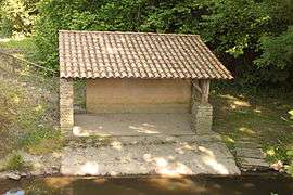
The washing house | ||
| ||
 Saint-Étienne-du-Bois | ||
|
Location within Pays de la Loire region  Saint-Étienne-du-Bois | ||
| Coordinates: 46°49′55″N 1°35′37″W / 46.8319°N 1.5936°WCoordinates: 46°49′55″N 1°35′37″W / 46.8319°N 1.5936°W | ||
| Country | France | |
| Region | Pays de la Loire | |
| Department | Vendée | |
| Arrondissement | Les Sables-d'Olonne | |
| Canton | Palluau | |
| Intercommunality | Pays de Palluau | |
| Government | ||
| • Mayor (2008–2014) | Gilles Douillard | |
| Area1 | 29.44 km2 (11.37 sq mi) | |
| Population (2006)2 | 1,672 | |
| • Density | 57/km2 (150/sq mi) | |
| Time zone | CET (UTC+1) | |
| • Summer (DST) | CEST (UTC+2) | |
| INSEE/Postal code | 85210 / 85670 | |
| Elevation | 17–64 m (56–210 ft) | |
|
1 French Land Register data, which excludes lakes, ponds, glaciers > 1 km² (0.386 sq mi or 247 acres) and river estuaries. 2 Population without double counting: residents of multiple communes (e.g., students and military personnel) only counted once. | ||

Saint-Étienne-du-Bois is a commune in the Vendée department in the Pays de la Loire region in western France.
Places and Monuments
The Chapel of Tulévrière [1]
In the hamlet of Tulévrière, stands a small chapel, only monument Catholic erected during the Vendée wars . It was erected by the inhabitants of the locality, at the request of the priest Alexandre Ténèbre, refractory priest in 1794 who gave it the name "Our Lady of Martyrs of Lower Poitou".
Inaugurated on 29 December 1794, it was intended to thank the Virgin of the protection afforded to the village during the passage of infernal columns in March of that year.
Rebuilt in 1835, it was decorated with stained glass for the occasion
See also
References
| Wikimedia Commons has media related to Saint-Étienne-du-Bois (Vendée). |