Saint-Jean-de-Chevelu
| Saint-Jean-de-Chevelu | |
|---|---|
|
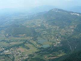
Saint-Jean-de-Chevelu seen from the nearby mountainside | |
 Saint-Jean-de-Chevelu | |
|
Location within Auvergne-Rhône-Alpes region  Saint-Jean-de-Chevelu | |
| Coordinates: 45°41′48″N 5°49′52″E / 45.6967°N 5.8311°ECoordinates: 45°41′48″N 5°49′52″E / 45.6967°N 5.8311°E | |
| Country | France |
| Region | Auvergne-Rhône-Alpes |
| Department | Savoie |
| Arrondissement | Chambéry |
| Canton | Yenne |
| Intercommunality | Yenne |
| Government | |
| • Mayor (2008–2014) | Jean-Pierre Lovisa |
| Area1 | 12.72 km2 (4.91 sq mi) |
| Population (2006)2 | 702 |
| • Density | 55/km2 (140/sq mi) |
| Time zone | CET (UTC+1) |
| • Summer (DST) | CEST (UTC+2) |
| INSEE/Postal code | 73245 / 73170 |
| Elevation | 295–1,443 m (968–4,734 ft) |
|
1 French Land Register data, which excludes lakes, ponds, glaciers > 1 km² (0.386 sq mi or 247 acres) and river estuaries. 2 Population without double counting: residents of multiple communes (e.g., students and military personnel) only counted once. | |
Saint-Jean-de-Chevelu is a commune in the Savoie department in the Auvergne-Rhône-Alpes region in south-eastern France.
See also
References
| Wikimedia Commons has media related to Saint-Jean-de-Chevelu. |
This article is issued from Wikipedia - version of the 10/28/2016. The text is available under the Creative Commons Attribution/Share Alike but additional terms may apply for the media files.