Saint-Maurice-de-Rotherens
| Saint-Maurice-de-Rotherens | |
|---|---|
|
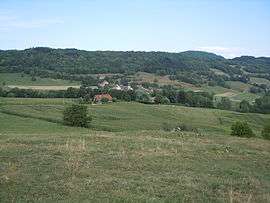
A general view of Saint-Maurice de Rotherens | |
 Saint-Maurice-de-Rotherens | |
|
Location within Auvergne-Rhône-Alpes region  Saint-Maurice-de-Rotherens | |
| Coordinates: 45°37′18″N 5°41′57″E / 45.6217°N 5.6992°ECoordinates: 45°37′18″N 5°41′57″E / 45.6217°N 5.6992°E | |
| Country | France |
| Region | Auvergne-Rhône-Alpes |
| Department | Savoie |
| Arrondissement | Chambéry |
| Canton | Saint-Genix-sur-Guiers |
| Intercommunality | Val de Guiers |
| Government | |
| • Mayor (2008–2014) | Daniel Revel |
| Area1 | 8.17 km2 (3.15 sq mi) |
| Population (2012)2 | 211 |
| • Density | 26/km2 (67/sq mi) |
| Time zone | CET (UTC+1) |
| • Summer (DST) | CEST (UTC+2) |
| INSEE/Postal code | 73260 / 73240 |
| Elevation | 376–880 m (1,234–2,887 ft) |
|
1 French Land Register data, which excludes lakes, ponds, glaciers > 1 km² (0.386 sq mi or 247 acres) and river estuaries. 2 Population without double counting: residents of multiple communes (e.g., students and military personnel) only counted once. | |
Saint-Maurice-de-Rotherens is a commune in the Savoie department in the Auvergne-Rhône-Alpes region in south-eastern France.
Geography
The commune is located on the ridge of Mont Tournier. Saint-Maurice-de-Rotherens is located 1,6 km from Gresin and 1,6 km from Gerbaix.
Demographics
During the last census in 2012, the commune had 211 residents.
See also
References
| Wikimedia Commons has media related to Saint-Maurice-de-Rotherens. |
This article is issued from Wikipedia - version of the 10/28/2016. The text is available under the Creative Commons Attribution/Share Alike but additional terms may apply for the media files.