Sainte-Agnès, Alpes-Maritimes
| Sainte-Agnès | ||
|---|---|---|
|
A view of the village of Sainte-Agnès seen from the road to Gorbio | ||
| ||
 Sainte-Agnès | ||
|
Location within Provence-A.-C.d'A. region 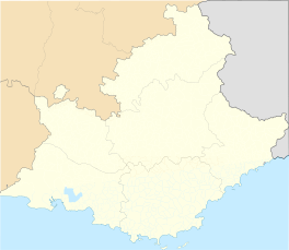 Sainte-Agnès | ||
| Coordinates: 43°48′05″N 7°27′44″E / 43.8014°N 7.4622°ECoordinates: 43°48′05″N 7°27′44″E / 43.8014°N 7.4622°E | ||
| Country | France | |
| Region | Provence-Alpes-Côte d'Azur | |
| Department | Alpes-Maritimes | |
| Arrondissement | Nice | |
| Canton | Menton-Ouest | |
| Intercommunality | Riviera française | |
| Government | ||
| • Mayor (2008–2014) | Albert Filippi | |
| Area1 | 9.37 km2 (3.62 sq mi) | |
| Population (2008)2 | 1,189 | |
| • Density | 130/km2 (330/sq mi) | |
| Time zone | CET (UTC+1) | |
| • Summer (DST) | CEST (UTC+2) | |
| INSEE/Postal code | 06113 / 06500 | |
| Elevation | 66–1,238 m (217–4,062 ft) | |
|
1 French Land Register data, which excludes lakes, ponds, glaciers > 1 km² (0.386 sq mi or 247 acres) and river estuaries. 2 Population without double counting: residents of multiple communes (e.g., students and military personnel) only counted once. | ||


Sainte-Agnès is a commune in the Alpes-Maritimes department in southeastern France.
Fort Maginot de Sainte Agnes is now a museum and was built as part of the Maginot Line in 1932. It sits overlooking the city of Menton and the Mediterranean.
The narrow road to the village provides views of Roquebrune Cap Martin, Menton and on to Italy.
Population
| Historical population | ||
|---|---|---|
| Year | Pop. | ±% |
| 1962 | 296 | — |
| 1968 | 304 | +2.7% |
| 1975 | 361 | +18.8% |
| 1982 | 455 | +26.0% |
| 1990 | 944 | +107.5% |
| 1999 | 1,094 | +15.9% |
| 2008 | 1,189 | +8.7% |
See also
References
| Wikimedia Commons has media related to Sainte-Agnès, Alpes-Maritimes. |
This article is issued from Wikipedia - version of the 1/30/2015. The text is available under the Creative Commons Attribution/Share Alike but additional terms may apply for the media files.