Tournefort, Alpes-Maritimes
| Tournefort | ||
|---|---|---|
|
The church of the old village and adjacent ruins | ||
| ||
 Tournefort | ||
|
Location within Provence-A.-C.d'A. region 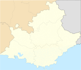 Tournefort | ||
| Coordinates: 43°56′51″N 7°09′06″E / 43.9475°N 7.1517°ECoordinates: 43°56′51″N 7°09′06″E / 43.9475°N 7.1517°E | ||
| Country | France | |
| Region | Provence-Alpes-Côte d'Azur | |
| Department | Alpes-Maritimes | |
| Arrondissement | Nice | |
| Canton | Villars-sur-Var | |
| Intercommunality | La Tinée | |
| Government | ||
| • Mayor (2008–2014) | Jacques Tuticci | |
| Area1 | 10.13 km2 (3.91 sq mi) | |
| Population (2008)2 | 149 | |
| • Density | 15/km2 (38/sq mi) | |
| Time zone | CET (UTC+1) | |
| • Summer (DST) | CEST (UTC+2) | |
| INSEE/Postal code | 06146 / 06710 | |
| Elevation |
171–1,304 m (561–4,278 ft) (avg. 630 m or 2,070 ft) | |
|
1 French Land Register data, which excludes lakes, ponds, glaciers > 1 km² (0.386 sq mi or 247 acres) and river estuaries. 2 Population without double counting: residents of multiple communes (e.g., students and military personnel) only counted once. | ||
_-_Eglise_du_vieux_village_et_ruines.JPG)

Tournefort is a commune in the Alpes-Maritimes department in southeastern France.
Population
| Historical population | ||
|---|---|---|
| Year | Pop. | ±% |
| 1962 | 31 | — |
| 1968 | 37 | +19.4% |
| 1975 | 46 | +24.3% |
| 1982 | 46 | +0.0% |
| 1990 | 93 | +102.2% |
| 1999 | 143 | +53.8% |
| 2008 | 149 | +4.2% |
See also
References
| Wikimedia Commons has media related to Tournefort, Alpes-Maritimes. |
This article is issued from Wikipedia - version of the 2/10/2016. The text is available under the Creative Commons Attribution/Share Alike but additional terms may apply for the media files.