Sotensko pri Šmarju
| Sotensko pri Šmarju | |
|---|---|
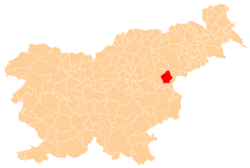
 Sotensko pri Šmarju Location in Slovenia | |
| Coordinates: 46°14′35.9″N 15°30′42.62″E / 46.243306°N 15.5118389°ECoordinates: 46°14′35.9″N 15°30′42.62″E / 46.243306°N 15.5118389°E | |
| Country |
|
| Traditional region | Styria |
| Statistical region | Savinja |
| Municipality | Šmarje pri Jelšah |
| Area | |
| • Total | 1.53 km2 (0.59 sq mi) |
| Elevation | 329.4 m (1,080.7 ft) |
| Population (2002) | |
| • Total | 106 |
| [1] | |
Sotensko pri Šmarju (pronounced [ˈsoːtɛnskɔ pɾi ˈʃmaːɾju]) is a settlement in the Municipality of Šmarje pri Jelšah in eastern Slovenia. It lies in the hills north of Šmarje. The area is part of the historical Styria region. The municipality is now included in the Savinja Statistical Region.[2]
Name
The name of the settlement was changed from Sotensko to Sotensko pri Šmarju in 1953.[3]
Church
The local church is dedicated to Saint Nicholas and belongs to the Parish of Šmarje pri Jelšah. It was built in the third quarter of the 18th century on the site of an earlier building.[4]
References
- ↑ Statistical Office of the Republic of Slovenia
- ↑ Šmarje pri Jelšah municipal site
- ↑ Spremembe naselij 1948–95. 1996. Database. Ljubljana: Geografski inštitut ZRC SAZU, DZS.
- ↑ Slovenian Ministry of Culture register of national heritage reference number ešd 3409
External links
This article is issued from Wikipedia - version of the 10/11/2016. The text is available under the Creative Commons Attribution/Share Alike but additional terms may apply for the media files.