St. Mary, Missouri
| St. Mary, Missouri | |
|---|---|
| City | |
|
The old Mississippi River bed at St. Mary, now just a small stream | |
 Location of St. Mary, Missouri | |
| Coordinates: 37°52′34″N 89°56′56″W / 37.87611°N 89.94889°WCoordinates: 37°52′34″N 89°56′56″W / 37.87611°N 89.94889°W | |
| Country | United States |
| State | Missouri |
| County | Ste. Genevieve |
| Area[1] | |
| • Total | 0.61 sq mi (1.58 km2) |
| • Land | 0.60 sq mi (1.55 km2) |
| • Water | 0.01 sq mi (0.03 km2) |
| Elevation | 384 ft (117 m) |
| Population (2010)[2] | |
| • Total | 360 |
| • Estimate (2012[3]) | 350 |
| • Density | 600.0/sq mi (231.7/km2) |
| Time zone | Central (CST) (UTC-6) |
| • Summer (DST) | CDT (UTC-5) |
| FIPS code | 29-65034[4] |
| GNIS feature ID | 0736343[5] |

St. Mary (Ste. Marie, with French spelling) is a city in Ste. Genevieve County, Missouri, United States. The population was 360 at the 2010 census.
Name
St. Mary had a number of nicknames, including Camp Rowdy and Yankeetown.[6] Eventually, the community came to be known as St. Mary's Landing and then simply as St. Mary's.[7]
History
The small city was established by settlers of French descent, who also built St. Mary's Catholic Church. The city was originally named St. Mary's Landing.
Geography
St. Mary is located at 37°52′34″N 89°56′56″W / 37.87611°N 89.94889°W (37.876153, -89.948811).[8]
St. Mary lies in the Grand Champ Bottoms. The community is bordered by Saint Laurent Creek to the south and Saline Creek to the north, with an offshoot of the Mississippi separating it from Kaskaskia Island to the east. According to the United States Census Bureau, the city has a total area of 0.61 square miles (1.58 km2), of which, 0.60 square miles (1.55 km2) is land and 0.01 square miles (0.03 km2) is water.[1]
Demographics
| Historical population | |||
|---|---|---|---|
| Census | Pop. | %± | |
| 1860 | 142 | — | |
| 1870 | 397 | 179.6% | |
| 1880 | 419 | 5.5% | |
| 1890 | 446 | 6.4% | |
| 1900 | 576 | 29.1% | |
| 1910 | 702 | 21.9% | |
| 1920 | 722 | 2.8% | |
| 1930 | 554 | −23.3% | |
| 1940 | 605 | 9.2% | |
| 1950 | 635 | 5.0% | |
| 1960 | 620 | −2.4% | |
| 1970 | 645 | 4.0% | |
| 1980 | 565 | −12.4% | |
| 1990 | 461 | −18.4% | |
| 2000 | 377 | −18.2% | |
| 2010 | 360 | −4.5% | |
| Est. 2015 | 348 | [9] | −3.3% |
2010 census
As of the census[2] of 2010, there were 360 people, 159 households, and 89 families residing in the city. The population density was 600.0 inhabitants per square mile (231.7/km2). There were 188 housing units at an average density of 313.3 per square mile (121.0/km2). The racial makeup of the city was 91.67% White, 4.72% Black or African American, 0.28% Native American, 0.83% from other races, and 2.50% from two or more races. Hispanic or Latino of any race were 1.94% of the population.
There were 159 households of which 25.2% had children under the age of 18 living with them, 37.7% were married couples living together, 11.9% had a female householder with no husband present, 6.3% had a male householder with no wife present, and 44.0% were non-families. 35.8% of all households were made up of individuals and 15.7% had someone living alone who was 65 years of age or older. The average household size was 2.26 and the average family size was 2.93.
The median age in the city was 40.9 years. 25% of residents were under the age of 18; 7.3% were between the ages of 18 and 24; 20.5% were from 25 to 44; 29.5% were from 45 to 64; and 17.8% were 65 years of age or older. The gender makeup of the city was 50.0% male and 50.0% female.
2000 census
As of the census[4] of 2000, there were 377 people, 167 households, and 100 families residing in the city. The population density was 625.3 people per square mile (242.6/km²). There were 187 housing units at an average density of 310.2 per square mile (120.3/km²). The racial makeup of the city was 92.84% White, 3.18% African American, 0.80% Native American, 1.59% from other races, and 1.59% from two or more races. Hispanic or Latino of any race were 2.12% of the population.
There were 167 households out of which 23.4% had children under the age of 18 living with them, 47.9% were married couples living together, 9.0% had a female householder with no husband present, and 40.1% were non-families. 32.3% of all households were made up of individuals and 15.0% had someone living alone who was 65 years of age or older. The average household size was 2.26 and the average family size was 2.93.
In the city the population was spread out with 23.6% under the age of 18, 6.9% from 18 to 24, 27.6% from 25 to 44, 25.5% from 45 to 64, and 16.4% who were 65 years of age or older. The median age was 39 years. For every 100 females there were 106.0 males. For every 100 females age 18 and over, there were 101.4 males.
The median income for a household in the city was $27,000, and the median income for a family was $31,964. Males had a median income of $34,375 versus $14,583 for females. The per capita income for the city was $16,825. About 7.9% of families and 13.2% of the population were below the poverty line, including 40.0% of those under age 18 and 4.1% of those age 65 or over.
Gallery
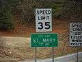 Road sign
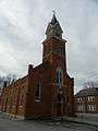 Immaculate Conception Roman Catholic Church
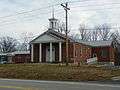 Trinity Baptist Church
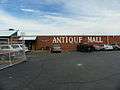 St. Mary Antique Mall
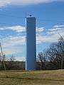 Watertower
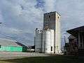 Grain Tower
Notable people
Sonny Siebert, baseball player.
References
- 1 2 "US Gazetteer files 2010". United States Census Bureau. Retrieved 2012-07-08.
- 1 2 "American FactFinder". United States Census Bureau. Retrieved 2012-07-08.
- ↑ "Population Estimates". United States Census Bureau. Retrieved 2013-05-30.
- 1 2 "American FactFinder". United States Census Bureau. Retrieved 2008-01-31.
- ↑ "US Board on Geographic Names". United States Geological Survey. 2007-10-25. Retrieved 2008-01-31.
- ↑ Michael Heim (2007). "Exploring Missouri Highways: Trip Trivia". ISBN 9780974435862.
- ↑ State Historical Society of Missouri: Ste. Genevieve County http://shs.umsystem.edu/manuscripts/ramsay/ramsay_sainte_genevieve.html
- ↑ "US Gazetteer files: 2010, 2000, and 1990". United States Census Bureau. 2011-02-12. Retrieved 2011-04-23.
- ↑ "Annual Estimates of the Resident Population for Incorporated Places: April 1, 2010 to July 1, 2015". Retrieved July 2, 2016.
- ↑ "Census of Population and Housing". Census.gov. Retrieved June 4, 2015.
External links
- Historic maps of St. Mary in the Sanborn Maps of Missouri Collection at the University of Missouri
Municipalities and communities of Sainte Genevieve County, Missouri, United States | ||
|---|---|---|
| Cities | 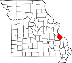 | |
| Townships | ||
| CDPs |
| |
| Other communities |
| |
| Ghost towns | ||