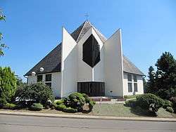
Starý Poddvorov
| Starý Poddvorov | |||
|---|---|---|---|
| Municipality | |||
 | |||
| |||
 Starý Poddvorov | |||
| Coordinates: 48°52′26″N 16°59′6″E / 48.87389°N 16.98500°ECoordinates: 48°52′26″N 16°59′6″E / 48.87389°N 16.98500°E | |||
| Country |
| ||
| Region | South Moravian | ||
| District | Hodonín | ||
| Area | |||
| • Total | 5.45 km2 (2.10 sq mi) | ||
| Elevation | 224 m (735 ft) | ||
| Population (1.1.2012) | |||
| • Total | 980 | ||
| • Density | 180/km2 (470/sq mi) | ||
| Postal code | 696 16 to 696 17 | ||
| Website | http://poddvorov.cz | ||
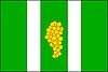
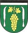
Starý Poddvorov is a village and municipality (obec) in Hodonín District in the South Moravian Region of the Czech Republic.
The municipality covers an area of 5.45 square kilometres (2.10 sq mi), and has a population of 969 (as at 1 January 2008).
Starý Poddvorov lies approximately 12 kilometres (7 mi) west of Hodonín, 46 km (29 mi) south-east of Brno, and 230 km (143 mi) south-east of Prague.
References
| Wikimedia Commons has media related to Starý Poddvorov. |
This article is issued from Wikipedia - version of the 4/7/2016. The text is available under the Creative Commons Attribution/Share Alike but additional terms may apply for the media files.