Star Peak (Nevada)
| Star Peak | |
|---|---|
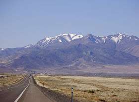 View of Star Peak from Milepost 157 on Interstate 80 | |
| Highest point | |
| Elevation | 9,840 ft (2,999 m) NAVD 88[1] |
| Prominence | 5,400 ft (1,646 m) [2] |
| Listing |
|
| Coordinates | 40°31′21″N 118°10′15″W / 40.522419614°N 118.17076805°WCoordinates: 40°31′21″N 118°10′15″W / 40.522419614°N 118.17076805°W [1] |
| Geography | |
 Star Peak Necada, U.S. | |
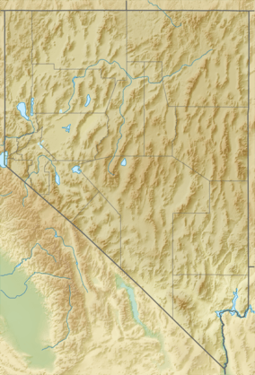
| Location | Pershing County, Nevada, U.S. |
| Parent range | Humboldt Range |
| Topo map | USGS Star Peak |
| Climbing | |
| Easiest route | 4-wheel route followed by a one mile hike, class 1[5][6] |
Star Peak is both the highest and most topographically prominent mountain in both the Humboldt Range and Pershing County in Nevada, United States. It is the sixth-most topographically prominent peak in Nevada.[7] The peak is on public land administered by the Bureau of Land Management and has no access restrictions.[5]
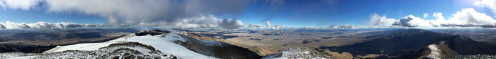
360-degree panorama from the summit
See also
References
- 1 2 "Star Peak". NGS data sheet. U.S. National Geodetic Survey. Retrieved 2015-01-22.
- ↑ "Star Peak, Nevada". Peakbagger.com. Retrieved 2016-08-10.
- ↑ "Nevada County High Points". Peakbagger.com. Retrieved 2016-08-10.
- ↑ "Great Basin Peaks List". Toiyabe Chapter, Sierra Club. Retrieved 2016-08-10.
- 1 2 "Star Peak". SummitPost.org. Retrieved 2015-01-22.
- ↑ "Ascent of Star Peak on 2014-06-30". Peakbagger.com. Retrieved 2016-08-10.
- ↑ "Nevada Peaks with 2000 feet of Prominence". Peakbagger.com. Retrieved 2015-01-22.
External links
| Wikimedia Commons has media related to Star Peak (Nevada). |
This article is issued from Wikipedia - version of the 8/24/2016. The text is available under the Creative Commons Attribution/Share Alike but additional terms may apply for the media files.