Stumpa Dúloigh
| Stumpa Dúloigh | |
|---|---|
| Maol | |
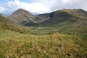 Bridia Valley, with Stumpa Dúloigh on the right | |
| Highest point | |
| Elevation | 784 m (2,572 ft) [1] |
| Prominence | 499 m (1,637 ft) [1] |
| Listing | Marilyn, Hewitt |
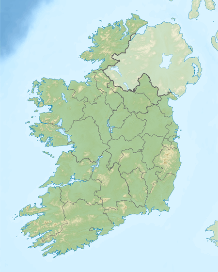
| Coordinates | 51°57′13.5″N 9°45′54.9″W / 51.953750°N 9.765250°WCoordinates: 51°57′13.5″N 9°45′54.9″W / 51.953750°N 9.765250°W |
| Naming | |
| Translation | Stump of the black lake (Irish) |
| Geography | |
 Stumpa Dúloigh | |
| Parent range | Dunkerron Mountains (Mountains of the Iveragh Peninsula) |
| OSI/OSNI grid | V787793 |
| Climbing | |
| Easiest route | scrambling |
Stumpa Dúloigh (meaning in Irish stump of the black lake[2] and also known as Maol) is the highest summit of the Dunkerron Mountains, part of the Mountains of the Iveragh Peninsula[3] in County Kerry, Ireland.
Geography
The mountain lies northwest of Knockaunanattin (569 m). West of Stumpa Dúloigh the Dunkerron range splits in two parts: the NE one leads to Broaghnabinnia (745 m) while the SE sub-range reaches Knocknabreeda (569 m). With an elevation of 784 metres it is the 55th highest summit in Ireland.
Access to the summit
Stumpa Dúloigh's summit can be accessed from the end of the Black Valley; it is a 6 hours' walk (there and back) suitable only for experienced hikers.[1]
References
- 1 2 3 "Dunkerron Mountains Area / Stumpa Dúloigh". MountainViews. Ordnance Survey Ireland. Retrieved June 9, 2015.
- ↑ Paul Tempan. "Irish Hill and Mountain Names" (PDF). www.mountaineering.ie. Mountaineering Ireland. Retrieved June 9, 2015.
- ↑ "Hills and Mountains of Britain and Ireland - Ireland : Iveragh Peninsula". www.walkingclub.org.uk. Saturday Walkers Club. Retrieved June 9, 2015.
External links
Lists of Marilyns | |
|---|---|
This article is issued from Wikipedia - version of the 2/7/2016. The text is available under the Creative Commons Attribution/Share Alike but additional terms may apply for the media files.