Sweet Water, Alabama
| Sweet Water, Alabama | |
|---|---|
| Town | |
 | |
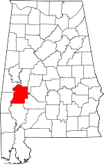
 Location in Marengo County and the state of Alabama | |
| Coordinates: 32°05′51″N 87°52′03″W / 32.09737°N 87.86751°W | |
| Country | United States |
| State | Alabama |
| County | Marengo |
| Area | |
| • Total | 2 sq mi (5 km2) |
| • Land | 2 sq mi (5 km2) |
| Elevation | 184 ft (56 m) |
| Population (2000) | |
| • Total | 258 |
| • Density | 117/sq mi (45/km2) |
| Time zone | Central (CST) (UTC-6) |
| • Summer (DST) | CDT (UTC-5) |
| ZIP code | 36782 |
| Area code(s) | 334 |
| FIPS code | 01-74304 |
| GNIS feature ID | 0153626 |

Sweet Water is a town in Marengo County, Alabama, United States. This town is twenty-four miles south of Linden. The community was founded during the 1840s. It was named for Sweet Water Creek, which runs through a section of the community.[1] The population was 258 during the 2010 census.[2] It is home to Sweet Water High School, part of the Marengo County Public School System. The current school was founded during the early 1870s.[3]
Geography

Sweet Water is located at 32°05′51″N 87°52′03″W / 32.09737°N 87.86751°WCoordinates: 32°05′51″N 87°52′03″W / 32.09737°N 87.86751°W and has an elevation of 184 feet (56 m).[4] According to the U.S. Census Bureau, the town has a total area of 2 square miles (5.2 km2), all land.[2]
Demographics
As of the census of 2010, there were 258 people, 94 households, and 72 families residing in the town. There were 111 housing units, of which 94 were occupied. The racial makeup of the town was 91.1% White, 7.8% Black or African American, and 1.2% from some other races. 1.2% of the population were Hispanic or Latino of any race.[2]
There were 94 households out of which 31.9% had children under the age of 18 living with them, 66.0% were married couples living together, 7.4% had a female householder with no husband present, 3.2% had a male householder with no wife present, and 23.4% were non-families. 22.3% of all households were made up of individuals and 14.9% had someone living alone who was 65 years of age or older. The average household size was 2.74 and the average family size was 3.22.[2]
The population was spread out with 70.9% 18 years and over, 68.2% 21 years and over, 20.5% 62 years and over, and 19.4% who were 65 years and over. The median age was 39 years.[2]
Famous Landmarks

The Sweet Water Cotton Gin
The town of Sweet Water is widely known for its iconic cotton gin and surrounding agricultural fields containing the southern crop. Sir William Jefferson Lewis, an affluent member of the community and a descendant from two wealthy French and German immigrant families to the land via Mobile in the 1770s, founded the gin and settled the many acres of land around the Tombigbee River that feeds it. The gin has been in operation since antebellum times; however, it caught fire at the hands of Union soldiers during the Civil War. The gin was rebuilt in 1870, and it has been running ever since, despite multiple recessions in the crop's market. In the early 1920s, the gin turned over profits that heavily surpassed those of similar corporations in nearby Selma and Mobile. These profits allowed for a renovation and minor relocation of the gin to its current home in 1927. To keep up with modern technological advances, the gin was upgraded to incorporate more efficient machinery in 1997. The business has been passed down within the same family of Lewis through countless generations. Currently, the family Rentz S. Lewis, Sr. owns and operates the timeless, truly Southern tradition.
Notable person
| Historical population | |||
|---|---|---|---|
| Census | Pop. | %± | |
| 1970 | 265 | — | |
| 1980 | 253 | −4.5% | |
| 1990 | 243 | −4.0% | |
| 2000 | 234 | −3.7% | |
| 2010 | 258 | 10.3% | |
| Est. 2015 | 246 | [5] | −4.7% |
| U.S. Decennial Census[6] 2013 Estimate[7] | |||
- David Beverly, former American football punter for the Houston Oilers and Green Bay Packers
References
- ↑ Marengo County Heritage Book Committee (2000). The Heritage of Marengo County, Alabama. Clanton, Alabama: Heritage Publishing Consultants. pp. 12–13. ISBN 9781891647581.
- 1 2 3 4 5 "American FactFinder". United States Census Bureau. Retrieved 2011-05-14.
- ↑ Marengo County Heritage Book Committee (2000). The Heritage of Marengo County, Alabama. Clanton, Alabama: Heritage Publishing Consultants. pp. 30–31. ISBN 9781891647581.
- ↑ U.S. Geological Survey Geographic Names Information System: Sweet Water
- ↑ "Annual Estimates of the Resident Population for Incorporated Places: April 1, 2010 to July 1, 2015". Retrieved July 2, 2016.
- ↑ "U.S. Decennial Census". Census.gov. Retrieved June 6, 2013.
- ↑ "Annual Estimates of the Resident Population: April 1, 2010 to July 1, 2013". Retrieved June 3, 2014.
| Wikimedia Commons has media related to Sweet Water, Alabama. |