Támesis, Antioquia
| Támesis, Antioquia | |||
|---|---|---|---|
| Municipality and town | |||
 | |||
| |||
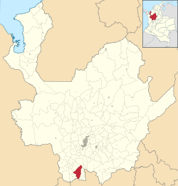 Location of the municipality and town of Támesis, Antioquia in the Antioquia Department of Colombia | |||
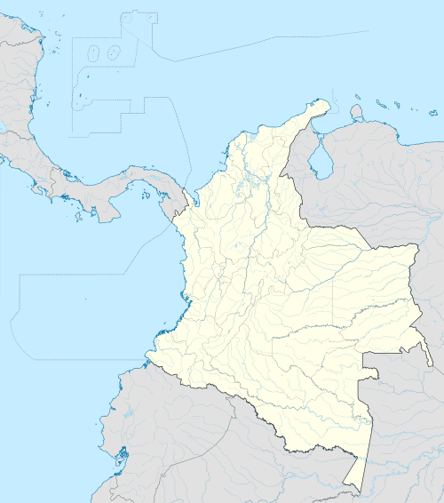 Támesis, Antioquia Location in Colombia | |||
| Coordinates: 5°39′53″N 75°42′52″W / 5.66472°N 75.71444°W | |||
| Country |
| ||
| Department |
| ||
| Subregion | Southwestern | ||
| Area | |||
| • Municipality and town | 243 km2 (94 sq mi) | ||
| • Urban | 1 km2 (0.4 sq mi) | ||
| Elevation | 1,638 m (5,374 ft) | ||
| Population | |||
| • Municipality and town | 16,500 | ||
| Time zone | Colombia Standard Time (UTC-5) | ||
| Website | http://www.tamesis-antioquia.gov.co/index.shtml | ||
.svg.png)

Támesis is a town and municipality in the Colombian department of Antioquia. Part of the subregion of Southwestern Antioquia. It was established in 1858. The local economy is based on agriculture.[1]
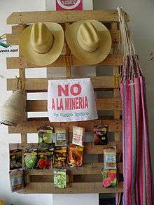
"No to the mine" sign in Támesis.
The main square — Parque Principal. Cerro de Cristo Rey in the background, covered by clouds.
Environmental issues
The mountains in the area, including the Cerro de Cristo Rey mountain overlooking Támesis and a sacred mountain to the Indians, contain valuable mineral deposits. There are plans to develop these resources, but these plans have met local opposition. Some locals are against mining in general, whereas others are questioning the regulation of mining activities that is seen as protecting the multinational companies.[2]
References
- ↑ "Sitio oficial de Támesis en Antioquia, Colombia". Administración Municipal. Retrieved 1 March 2014.
- ↑ Carlos Mario Cano R. (20 November 2012). "Caminata contra la minería pasará por siete pueblos antioqueños". El Tiempo. Retrieved 1 March 2014.
Capital: Medellín | |||||||||||||||||||||||||||||||||||
| Regions and municipalities |
| ||||||||||||||||||||||||||||||||||
| Related topics | |||||||||||||||||||||||||||||||||||
Coordinates: 5°40′N 75°43′W / 5.667°N 75.717°W
This article is issued from Wikipedia - version of the 8/24/2016. The text is available under the Creative Commons Attribution/Share Alike but additional terms may apply for the media files.