Tamalco Township, Bond County, Illinois
| Tamalco Township | |
|---|---|
| Township | |
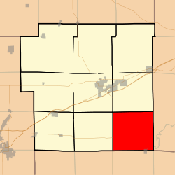 Location in Bond County | |
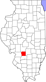 Bond County's location in Illinois | |
| Coordinates: 38°46′50″N 89°18′47″W / 38.78056°N 89.31306°WCoordinates: 38°46′50″N 89°18′47″W / 38.78056°N 89.31306°W | |
| Country | United States |
| State | Illinois |
| County | Bond |
| Settlement | November 6, 1888 |
| Area | |
| • Total | 38.11 sq mi (98.7 km2) |
| • Land | 37.17 sq mi (96.3 km2) |
| • Water | 0.94 sq mi (2.4 km2) 2.47% |
| Elevation | 482 ft (147 m) |
| Population (2010) | |
| • Total | 566 |
| • Density | 15.2/sq mi (5.9/km2) |
| Time zone | CST (UTC-6) |
| • Summer (DST) | CDT (UTC-5) |
| ZIP codes | 62246, 62253, 62284 |
| GNIS feature ID | 0429823 |
Tamalco Township is one of nine townships in Bond County, Illinois, USA. As of the 2010 census, its population was 566 and it contained 278 housing units.[1]
Geography
According to the 2010 census, the township has a total area of 38.11 square miles (98.7 km2), of which 37.17 square miles (96.3 km2) (or 97.53%) is land and 0.94 square miles (2.4 km2) (or 2.47%) is water.[1]
Cities
- Keyesport (northwest half)
Unincorporated towns
Cemeteries
The township contains these four cemeteries: Duncan, McKendree, Payne and Saint Peters.
Major highways
Lakes
- Carlyle Lake
School districts
- Bond County Community Unit School District 2
- Carlyle Community Unit School District 1
- Mulberry Grove Community Unit School District 1
Political districts
- Illinois' 19th congressional district
- State House District 102
- State Senate District 51
References
- "Tamalco Township, Bond County, Illinois". Geographic Names Information System. United States Geological Survey. Retrieved 2010-01-04.
- United States Census Bureau 2007 TIGER/Line Shapefiles
- United States National Atlas
- 1 2 "Population, Housing Units, Area, and Density: 2010 - County -- County Subdivision and Place -- 2010 Census Summary File 1". United States Census. Retrieved 2013-05-28.
External links

Municipalities and communities of Bond County, Illinois, United States | ||
|---|---|---|
| City | ||
| Villages | ||
| Townships | ||
| Unincorporated communities | ||
| Ghost town | ||
| Footnotes | ‡This populated place also has portions in an adjacent county or counties | |
This article is issued from Wikipedia - version of the 7/16/2016. The text is available under the Creative Commons Attribution/Share Alike but additional terms may apply for the media files.