Tancítaro
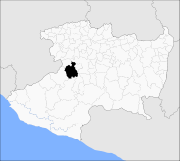
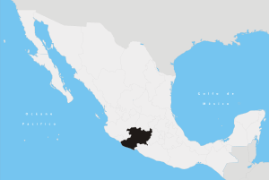
Tancítaro is a city and municipality in the western part of the Mexican state of Michoacán, in Southwestern Mexico. Its municipal seat is the City of Tancítaro.
Geography
The municipality has an area of 717.65 square kilometres (1.21% of the surface of the state).[1]
It is bordered to the north by the municipalities of Peribán and Uruapan, to the east by Nuevo Parangaricutiro, to southeast by Parácuaro, to the south by Apatzingán, and to the southwest by Buenavista.
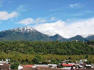
A volcanic peak, Pico de Tancítaro or Volcán Tancítaro, is located in the municipality. At 3,845 metres (12,615 ft) in elevation, it is the highest point in Michoacán state.
The municipality had a population of 26,089 inhabitants according to the 2005 census.[2]
Criminal activities
Due to its increase in criminal activity in the area, its 60 man Municipal Police Force was disbanded in December 2009. Soon after the people of michoacan began taking arms against the drug traffickers and against organized crime. They called them selfes "auto defensas".[3]
Mayor Gustavo Santoro and an aide were found dead September 27, 2010. It is believed they had been murdered by stoning.[4]
Pareo
References
- ↑ Michoacán Enciclopedia de los Municipios de México. Retrieved on October 9, 2007
- ↑ "2005 Census". INEGI: Instituto Nacional de Estadística, Geografía e Informática. Retrieved 2007-10-09.
- ↑ http://www.milenio.com/node/356006
- ↑ http://www.alertnet.org/thenews/newsdesk/N2797658.htm
Coordinates: 19°20′16″N 102°21′45″W / 19.33778°N 102.36250°W