Zináparo (municipality)
| Zináparo Municipality | |
|---|---|
| Municipality | |
|
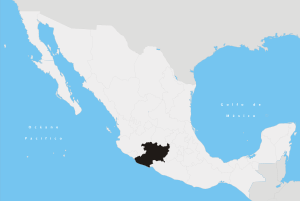
Zináparo Municipality Location of Zináparo in Mexico | |
| Coordinates: 20°10′N 102°00′W / 20.167°N 102.000°WCoordinates: 20°10′N 102°00′W / 20.167°N 102.000°W | |
| Country |
|
| State | Michoacán |
| Established | 1927 |
| Municipal seat | Zináparo |
| Government | |
| • Municipal president | Samuel Canchola Venegas (PRI) |
| Area | |
| • Total | 113.38 km2 (43.78 sq mi) |
| Elevation | 1,840 m (6,040 ft) |
| Population (1995) | |
| • Total | 2,465 |
| • Density | 22/km2 (56/sq mi) |
| Time zone | CST (UTC-6) |
| • Summer (DST) | CDT (UTC-5) |
Zináparo is a municipality in the Mexican state of Michoacán.[1]
Political entity
The municipality is located in the north part of Michoacán, in the Bajío region, 145 kilometers from the state capital of Morelia. It has a territory of 113.38 square kilometers, it borders the municipalities of La Piedad, Numarán, Penjamillo and Churintzio. The municipal government is constituted by: one municipal president, four councils of relative majority and three councils of proportional representation. Their main economic activities are agriculture, trade and pottery.[1]
Geography and environment
It has an average altitude of 1840 meters (1,480 ft) above sea level. Its relief is mainly constituted by the transversal volcanic system and the Purépero hills. There are no important streams, only small springs. The climate is temperate with temperatures that range between 14º and 30º degrees C. It is relatively dry with rains in the summer. The annual average rainfall is 900.0 mm.
The ecosystem is dominated by nopales, prairie, pastureland and mixed forest with pine and oak trees. Typical fauna includes species such as coyotes, ducks, turtledoves, squirrels and weasel.[1]
History
Zináparo is a Chichimeca name which means "obsidian place" even though it can be translated to "place of doctors". It was a preHispanic population, and it was first recognized by the Spanish government in 1613. In 1822, Zináparo was a community of cargo transporters and farmers. In 1863, it became a municipality, being added to La Piedad district. In 1894, it lost its municipal status under a territorial law issued that year. In 1903, it was recognized by Michoacán's government as a municipality once again.[1]
References
- 1 2 3 4 "Zináparo". Enciclopedia de los Municipios y Delegaciones de México. INAFED. 2010. Retrieved 2015. Check date values in:
|access-date=(help)