Tangier, Indiana
| Tangier | |
|---|---|
| Unincorporated community | |
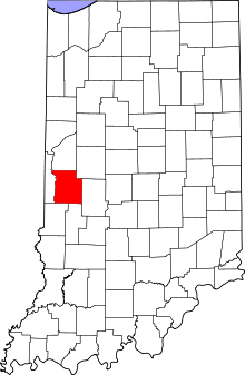 Parke County's location in Indiana | |
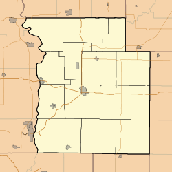 Tangier Location in Parke County | |
| Coordinates: 39°55′09″N 87°19′05″W / 39.91917°N 87.31806°WCoordinates: 39°55′09″N 87°19′05″W / 39.91917°N 87.31806°W | |
| Country |
|
| State |
|
| County | Parke County |
| Township | Liberty Township |
| Elevation | 192 m (630 ft) |
| ZIP code | 47952 |
| GNIS feature ID | 444565[1] |
Tangier (also called Long Siding or Woodys Corner) is an unincorporated community in Liberty Township, Parke County, Indiana, United States.
History
Tangier was platted in 1886.[2] The community was named after Tangier, in Morocco.[3] A post office was established at Tangier in 1886, and remained in operation until 1994.[4]
Geography
Tangier is located at 39°55′09″N 87°19′05″W / 39.91917°N 87.31806°W at an elevation of 630 feet.
References
- ↑ "Tangier". Geographic Names Information System. United States Geological Survey. Retrieved 2010-11-01.
- ↑ History of Parke and Vermillion Counties, Indiana. B.F. Bowen & Cos. 1913. p. 194.
- ↑ Baker, Ronald L. (October 1995). From Needmore to Prosperity: Hoosier Place Names in Folklore and History. Indiana University Press. p. 320. ISBN 978-0-253-32866-3.
...suggested naming the village for Tangier, Morocco.
- ↑ "Parke County". Jim Forte Postal History. Retrieved 30 September 2015.
Municipalities and communities of Parke County, Indiana, United States | ||
|---|---|---|
| Towns | ||
| Townships | ||
| Unincorporated communities |
| |
| Footnotes | ‡This populated place also has portions in an adjacent county or counties | |
This article is issued from Wikipedia - version of the 10/26/2016. The text is available under the Creative Commons Attribution/Share Alike but additional terms may apply for the media files.