Bloomingdale, Indiana
| Bloomingdale | |
|---|---|
| Town | |
.jpg) | |
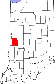 Parke County's location in Indiana | |
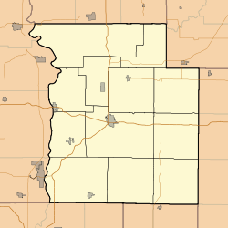 Bloomingdale Location in Parke County | |
| Coordinates: 39°49′54″N 87°14′58″W / 39.83167°N 87.24944°WCoordinates: 39°49′54″N 87°14′58″W / 39.83167°N 87.24944°W | |
| Country |
|
| State |
|
| County | Parke |
| Township | Penn |
| Area[1] | |
| • Total | 1.50 km2 (0.58 sq mi) |
| • Land | 1.50 km2 (0.58 sq mi) |
| • Water | 0 km2 (0 sq mi) |
| Elevation[2] | 196 m (643 ft) |
| Population (2010)[3] | |
| • Total | 335 |
| • Estimate (2012)[4] | 333 |
| • Density | 223.0/km2 (577.6/sq mi) |
| Time zone | EST (UTC-5) |
| • Summer (DST) | EST (UTC-5) |
| ZIP code | 47832 |
| Area code | 765 |
| FIPS code[2][5] | 18-05788 |
| GNIS ID[2][5] | 431202 |
Bloomingdale is a town in Penn Township, Parke County, Indiana, United States. The population was 335 at the 2010 census.
History
The town of Bloomingdale was platted in 1825 or 1826, south of its present location. Originally it was named Bloomfield.[6] A post office called Bloomingdale has been in operation since 1860.[7]
The William Hill Polygonal Barn was listed on the National Register of Historic Places in 1993.[8]
Geography
Bloomingdale is located about 6 miles (9.7 km) north of the county seat of Rockville. U.S. Route 41 passes less than a mile to the east of the town.[9]
According to the 2010 census, Bloomingdale has a total area of 0.58 square miles (1.50 km2), all land.[1]
Demographics
| Historical population | |||
|---|---|---|---|
| Census | Pop. | %± | |
| 1880 | 355 | — | |
| 1890 | 431 | 21.4% | |
| 1900 | 505 | 17.2% | |
| 1910 | 528 | 4.6% | |
| 1920 | 479 | −9.3% | |
| 1930 | 412 | −14.0% | |
| 1940 | 432 | 4.9% | |
| 1950 | 434 | 0.5% | |
| 1960 | 455 | 4.8% | |
| 1970 | 391 | −14.1% | |
| 1980 | 409 | 4.6% | |
| 1990 | 341 | −16.6% | |
| 2000 | 319 | −6.5% | |
| 2010 | 335 | 5.0% | |
| Est. 2015 | 327 | [10] | −2.4% |
2010 census
As of the 2010 census,[3] there were 335 people, 129 households, and 96 families residing in the town. The population density was 577.6 inhabitants per square mile (223.0/km2). There were 150 housing units at an average density of 258.6 per square mile (99.8/km2). The racial makeup of the town was 97.6% White, 0.3% African American, and 2.1% from two or more races. Hispanic or Latino of any race were 0.3% of the population.
There were 129 households of which 35.7% had children under the age of 18 living with them, 55.8% were married couples living together, 14.0% had a female householder with no husband present, 4.7% had a male householder with no wife present, and 25.6% were non-families. 20.9% of all households were made up of individuals and 11.6% had someone living alone who was 65 years of age or older. The average household size was 2.60 and the average family size was 3.02.
The median age in the town was 38.5 years. 23.6% of residents were under the age of 18; 10.9% were between the ages of 18 and 24; 22.8% were from 25 to 44; 30.2% were from 45 to 64; and 12.8% were 65 years of age or older. The gender makeup of the town was 50.4% male and 49.6% female.
2000 census
As of the 2000 census,[12] there were 319 people, 135 households, and 88 families residing in the town. The population density was 558.7 people per square mile (216.1/km²). There were 159 housing units at an average density of 278.5 per square mile (107.7/km²). The racial makeup of the town was 99.06% White, 0.31% African American, 0.31% Pacific Islander, and 0.31% from two or more races.
There were 135 households out of which 27.4% had children under the age of 18 living with them, 54.1% were married couples living together, 8.1% had a female householder with no husband present, and 34.8% were non-families. 31.1% of all households were made up of individuals and 16.3% had someone living alone who was 65 years of age or older. The average household size was 2.36 and the average family size was 2.99.
In the town the population was spread out with 25.4% under the age of 18, 6.9% from 18 to 24, 29.5% from 25 to 44, 24.1% from 45 to 64, and 14.1% who were 65 years of age or older. The median age was 38 years. For every 100 females there were 84.4 males. For every 100 females age 18 and over, there were 85.9 males.
The median income for a household in the town was $36,500, and the median income for a family was $46,071. Males had a median income of $27,308 versus $20,417 for females. The per capita income for the town was $17,928. About 2.2% of families and 2.0% of the population were below the poverty line, including none of those under age 18 and 4.9% of those age 65 or over.
References
- 1 2 "G001 - Geographic Identifiers - 2010 Census Summary File 1". United States Census Bureau. Retrieved 2015-07-13.
- 1 2 3 "Feature ID 431202". Geographic Names Information System. United States Geological Survey. Retrieved June 30, 2014.
- 1 2 "American FactFinder". United States Census Bureau. Retrieved 2012-12-11.
- ↑ "Incorporated Places and Minor Civil Divisions Datasets: Subcounty Resident Population Estimates: April 1, 2010 to July 1, 2012". United States Census Bureau. Archived from the original on 2013-06-17. Retrieved 2013-06-25.
- 1 2 "FIPS55 Data: Indiana". FIPS55 Data. United States Geological Survey. February 23, 2006. Archived from the original on June 18, 2006. Retrieved June 30, 2014.
- ↑ Bowen 1913, p. 196.
- ↑ "Parke County". Jim Forte Postal History. Archived from the original on 1 October 2015. Retrieved 30 September 2015.
- ↑ National Park Service (2010-07-09). "National Register Information System". National Register of Historic Places. National Park Service.
- ↑ Google (2012-01-14). "Bloomingdale, Indiana" (Map). Google Maps. Google. Retrieved 2012-01-14.
- ↑ "Annual Estimates of the Resident Population for Incorporated Places: April 1, 2010 to July 1, 2015". Retrieved July 2, 2016.
- ↑ "Census of Population and Housing". Census.gov. Archived from the original on May 11, 2015. Retrieved June 4, 2015.
- ↑ "American FactFinder". United States Census Bureau. Archived from the original on 2013-09-11. Retrieved 2008-01-31.
Bibliography
- History of Parke and Vermillion Counties Indiana. Indianapolis: B. F. Bowen and Company. 1913. pp. 25–225. Retrieved 2010-12-17.
Municipalities and communities of Parke County, Indiana, United States | ||
|---|---|---|
| Towns | ||
| Townships | ||
| Unincorporated communities |
| |
| Footnotes | ‡This populated place also has portions in an adjacent county or counties | |