Waldorf, Maryland
| Waldorf, Maryland | |
|---|---|
| Census-designated place | |
|
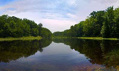
A pond fed by the Wolf Den Branch in Cedarville State Forest. | |
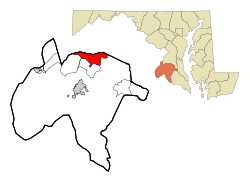 Location of Waldorf, Maryland | |
| Coordinates: 38°38′46″N 76°53′54″W / 38.64611°N 76.89833°WCoordinates: 38°38′46″N 76°53′54″W / 38.64611°N 76.89833°W | |
| Country | United States |
| State | Maryland |
| County | Charles |
| Area | |
| • Total | 36.5 sq mi (94.5 km2) |
| • Land | 36.2 sq mi (93.8 km2) |
| • Water | 0.3 sq mi (0.7 km2) |
| Elevation | 207 ft (63 m) |
| Population (2010) | |
| • Total | 67,752 |
| • Density | 1,900/sq mi (720/km2) |
| Time zone | Eastern (EST) (UTC-5) |
| • Summer (DST) | EDT (UTC-4) |
| ZIP codes | 20601-20604 |
| Area code(s) | 301, 240 |
| FIPS code | 24-81175 |
| GNIS feature ID | 0588020 |
Waldorf is an unincorporated community and census-designated place in Charles County, Maryland, United States. It is 23 miles (37 km) south-southeast of Washington, D.C. The population of the census-designated area (now including the large planned community of St. Charles) was 67,752 at the 2010 census.[1] Waldorf was settled before 1900 as a rural crossroads with a train station and was called "Beantown" after a local family.
History
Waldorf's original name was Beantown. During his post assassination flight, John Wilkes Booth told a road sentry he was headed to his home in Charles County near Beantown and was allowed to proceed.[2] In 1880, the General Assembly of Maryland by an act changed the name to "Waldorf" in honor of William Waldorf Astor (1848–1919), the great-grandson of John Jacob Astor (1763–1848), who was born in Walldorf, Palatinate, Germany.[3] On July 29, 1908, the city of Plumb Valley in Waseca County, Minnesota, changed its name to Waldorf after Waldorf, Maryland.[4]
Once a tobacco market village, Waldorf came to prominence in the 1950s as a gambling destination after slot machines were legalized in Charles County in 1949. The boom lasted until 1968 when gambling was once again outlawed.[5] Its subsequent substantial growth as a residential community began with a 1970 loan package from the Department of Housing and Urban Development which fueled the giant planned community of St. Charles, south of Waldorf.
St. Catharine, or the Dr. Samuel A. Mudd House, was listed on the National Register of Historic Places in 1974.[6]
Economy and demographics
Waldorf is predominantly a bedroom community for many residents who commute to work at other points in the Washington, D.C., metropolitan area, especially personnel at Andrews Air Force Base. Waldorf's local jobs are primarily in the service and sales industry. Nearby St. Charles Towne Center, a 2-story shopping mall, opened in 1988[7] and was remodeled in 2007. St. Charles Towne Center draws shoppers and diners from several Maryland counties, Washington, and parts of Virginia, causing Charles County to be promoted as the "shopping capital of Southern Maryland." U.S. Route 301, the main highway through the town, boasts the "Waldorf Motor Mile," with car dealerships located primarily along the northbound side. In 2005, Waldorf opened its third public high school (North Point High School),[8] which has advanced science/technology programs; the Capital Clubhouse 24-hour indoor sports complex and ice rink also opened that year.[9] A fourth public high school opened in 2014 called St. Charles High School.[10] Thomas Stone and Westlake High Schools are also located in Waldorf. Waldorf has a branch of the College of Southern Maryland. In 2006, plans were announced to build two more shopping centers, including one with high-end stores and an attractive "lifestyle" town center design layout. Ground was also broken to build an office park with mid-rise office buildings at the intersection of Western Parkway and Route 228 (Berry Road); the Residence Inn opened there in 2010, and another new hotel has opened across the road. The Southern Maryland Blue Crabs baseball team is also in Waldorf.
Geography
Waldorf is located at 38°38′46″N 76°53′54″W / 38.64611°N 76.89833°W (38.646173, -76.898217).[11]
According to the United States Census Bureau, the CDP has a total area of 36.5 square miles (94.5 km2), of which 36.2 square miles (93.8 km2) is land and 0.27 square miles (0.7 km2), or 0.72%, is water.[12]
Most of Waldorf is flat, particularly the eastern part of the city. There are small hills to the west, and much of the southern and eastern parts of the city are wetlands, featuring very diverse wildlife in ponds and streams. Waldorf is forested, mostly with oak and pine trees.
Farming
Even though Waldorf is a rapidly developing urbanized area, the community is surrounded by farms. These farms include:
- Shlagel Farms, a major strawberry farm that offers vegetables and flowers,[13][14] along with Angus beef
- Middleton's Cedar Hill farm[15]
- Middleton Manor Farms[16][17]
Tobacco, once a dominant crop in Southern Maryland, has nearly disappeared as a crop grown by farmers, since most area farmers accepted buy-outs during the 1990s from the Maryland state government.
Surrounding places
Waldorf's neighbors are as follows: Prince George's County (north), Bennsville (west), La Plata (south). On the east, from north to south there are Cedarville State Forest, Malcolm and Bryantown.
Climate
The climate in this area is characterized by hot, humid summers and generally mild to cool winters. According to the Köppen Climate Classification system, Waldorf has a humid subtropical climate, abbreviated "Cfa" on climate maps.[18]
Demographics
2010
| | ||
| Race | Population | % of Total |
|---|---|---|
| Total | 67,752 | 100 |
| African American | 36,152 | 53 |
| Caucasian | 24,052 | 35 |
| Hispanic | 3,972 | 5 |
| Two or More Races | 3,078 | 4 |
| Asian | 2,664 | 3 |
| Other | 1,382 | 2 |
| Three or more races | 446 | < 1% |
| American Indian | 363 | < 1% |
| [19] | ||
2000
As of the census[20] of 2000, there were 22,312 people, 7,603 households, and 5,991 families residing in the CDP. In the CDP, the population density was 1,746.0 people per square mile (674.1/km²). There were 7,827 housing units at an average density of 612.5 per square mile (236.5/km²). The racial makeup of the CDP was 61.11% White, 31.98% African American, 0.54% Native American, 2.59% Asian, 0.02% Pacific Islander, 0.88% from other races, and 2.88% from two or more races. Hispanic or Latino of any race were 2.91% of the population.
There were 7,603 households out of which 45.5% had children under the age of 18 living with them, 58.6% were married couples living together, 15.5% had a female householder with no husband present, and 21.2% were non-families. 14.8% of all households were made up of individuals and 2.2% had someone living alone who was 65 years of age or older. The average household size was 2.93 and the average family size was 3.24.
In the CDP the population was spread out with 30.6% under the age of 18, 7.5% from 18 to 24, 36.4% from 25 to 44, 20.7% from 45 to 64, and 4.8% who were 65 years of age or older. The median age was 33 years. For every 100 females there were 94.4 males. For every 100 females age 18 and over, there were 90.8 males.
The median income for a household in the CDP was $68,869, and the median income for a family was $71,439 (these figures had risen to $86,901 and $94,432 respectively as of a 2007 estimate[21]). Males had a median income of $45,293 versus $35,386 for females. The per capita income for the CDP was $24,728. About 2.7% of families and 4.4% of the population were below the poverty line, including 6.4% of those under age 18 and 2.2% of those age 65 or over.
Transportation
The major routes in Waldorf are:
- U.S. Route 301, running north to south between Brandywine to the north and La Plata to the south. It is lined continuously for several miles with shopping centers, restaurants, car dealers, and other businesses.
The Governor Harry W. Nice Memorial Bridge on Route 301 provides a road connection from Waldorf to Virginia. Although the bridge is outmoded and narrow (2-lane), it is nevertheless used by some long-distance East Coast through-motorists as a travel alternative to Interstate 95/495 which often has major traffic backups (see Woodrow Wilson Bridge). In the years to come, due to traffic concerns, a bypass may be built through either western or eastern Waldorf, or the highway may continue on the same route through Waldorf with overpasses. This will give an interstate feel to the Waldorf area and ultimately take away traffic congestion to the north-south routes in Waldorf.
- Maryland Route 5 (Leonardtown Road), which joins US 301 in Brandywine to the north and splits at the county line to bypass Waldorf on Mattawoman-Beantown Road. It runs from Washington, D.C. and Brandywine in the north to Hughesville and the southern tip of Maryland. A minor league professional baseball stadium for the Southern Maryland Blue Crabs baseball team is accessible from Route 5 via Billingsley Road. MD 5 also has a small business corridor which runs westward from the intersection of Mattawoman-Beantown Road, St. Charles Parkway, and Leonardtown Road until its terminus at US 301.
- Maryland Route 228 (Berry Road) starts in Accokeek at the intersection of Maryland Route 210 (Indian Head Highway) and runs through much of western Waldorf until its eastern terminus in central Waldorf, at the intersection of MD 228, MD 5 Business, and US 301. The intersection of MD 228 and MD 210 in Accokeek is one of only six Continuous flow intersections in the United States.
- Maryland Route 925, also known as Old Washington Road, runs north to south through Waldorf nearly parallel to US 301.
- St. Charles Parkway, which lies in the eastern side of the city, is a scenic, landscaped major thoroughfare within the city, passing by White Plains Regional Park. This is sometimes referred to as the most beautiful road in Waldorf, especially during the spring, summer and autumn months. In 2008, this road was extended south to the county seat, La Plata, providing an alternative travel route to US 301 between Waldorf and La Plata.
Public transportation is provided by Van-Go, a bus system administered by Charles County for most of the county, including Waldorf, and interconnecting to nearby St.Mary's County Transit System buses.[22] MTA Maryland has four commuter routes (901, 903, 905, and 907, all operated by Dillons Transportation except the 903 which is serviced by Keller Transportation) that takes commuters to and from downtown Washington, D.C., and ridership is rapidly growing. Waldorf has seven park & ride lots served by MTA Maryland routes: two at St. Charles Towne Center, one at St. Charles Towne Plaza, one at Smallwood Drive and US 301, one on Mattawoman Beantown Road, one at Smallwood Village Center, and one at Regency Furniture Stadium.
Vehicular Traffic
Vehicular traffic in Waldorf is usually congested, and the state is still evaluating options for a U.S. Route 301 bypass around western Waldorf. Through Virginia and Maryland, US 301 along with U.S. Route 17 are used as alternate routes from I-95, due to I-95 vehicular traffic congestion. Due to Waldorf's bedroom community nature and lack of any significant hometown industry, its highways can become very congested in the morning commutes north to Washington, and also on Friday through Sunday in every direction due to shoppers, many of them visiting from other counties. Much of the congestion is seen at the intersection of Route 228 and 301 and Community Drive, on Berry Road going westward to Western Parkway, near St. Patrick's Drive, on Mall Circle surrounding St. Charles Towne Center, and on Smallwood Drive near the neighborhood of Carrington. Most vehicular traffic is in the southern areas of Waldorf.
Sports
| Club | League | Venue | Established | Championships |
|---|---|---|---|---|
| Southern Maryland Blue Crabs | ALPB, Baseball | Regency Furniture Stadium | 2008 | 0 |
Notes
- ↑ "Profile of General Population and Housing Characteristics: 2010 Demographic Profile Data (DP-1): Waldorf CDP, Maryland". U.S. Census Bureau, American Factfinder. Retrieved August 3, 2012.
- ↑ http://www.eyewitnesstohistory.com/booth.htm
- ↑ Herbert C. Ebeling: William Waldorf Astor. (Walldorf: Astor-Stiftung, 2007, p. 106).
- ↑ Herbert C. Ebeling: William Waldorf Astor. (Walldorf: Astor-Stiftung, 2007, pp. 107+113).
- ↑ Janis, Stephen (2004-12-01). "Feature: What Can Maryland's Troubled History with Slot Machines Tell Us About the Odds for the Future?". Baltimore City Paper. Retrieved 2008-04-18.
- ↑ National Park Service (2008-04-15). "National Register Information System". National Register of Historic Places. National Park Service.
- ↑ "St. Charles Towne Center". American Community Properties Trust. Archived from the original on 2008-03-22. Retrieved 2008-04-18.
- ↑ "Charles County MD Board of Ed page on high schools". Retrieved 2011-10-04.
- ↑ "Capital Clubhouse". m2architects. Retrieved 2012-06-12.
- ↑ "Charles County MD Board of Ed page on news". Retrieved 2012-05-06.
- ↑ "US Gazetteer files: 2010, 2000, and 1990". United States Census Bureau. 2011-02-12. Retrieved 2011-04-23.
- ↑ "Geographic Identifiers: 2010 Demographic Profile Data (G001): Waldorf CDP, Maryland". U.S. Census Bureau, American Factfinder. Retrieved August 3, 2012.
- ↑ "Shlagel Farms in Waldorf, Maryland". GardenGuides.com. Retrieved 2008-04-18.
- ↑ "National Capital Farms". Metropolitan Washington Regional Agricultural Workgroup. Retrieved 2008-04-18.
- ↑ "Middleton's Cedar Hill Farm". Tri-County Council for Southern Maryland. Retrieved 2008-04-18.
- ↑ "Middleton Manor Farms, Inc.". Tri-County Council for Southern Maryland. Retrieved 2008-04-18.
- ↑ "Middleton Manor Farms Inc - Nursery". GardenGuides.com. Retrieved 2012-04-18.
- ↑ Climate Summary for Waldorf, Maryland
- ↑ "Waldorf Maryland Population Statistics". US Census Bureau. Retrieved May 29, 2013.
- ↑ "American FactFinder". United States Census Bureau. Retrieved 2008-01-31.
- ↑ http://factfinder.census.gov/servlet/ADPTable?_bm=y&-context=adp&-qr_name=ACS_2007_3YR_G00_DP3YR3&-ds_name=ACS_2007_3YR_G00_&-tree_id=3307&-redoLog=false&-_caller=geoselect&-geo_id=16000US2481175&-format=&-_lang=en
- ↑ "VanGO Cover Original". Charles County Department of Community Services. Retrieved 2008-04-18.
External links
 |
Fort Washington |
Brandywine |
Cedarville |
| |||
| |
|||||||
| Accokeek |
|
Aquasco | |||||
| |
|||||||
| Bennsville |
La Plata |
Hughesville |
Municipalities and communities of Charles County, Maryland, United States | ||
|---|---|---|
| Towns |  | |
| CDPs | ||
| Other communities | ||
| Principal cities |
| |||||||||||
|---|---|---|---|---|---|---|---|---|---|---|---|---|
| Counties and county equivalents* |
| |||||||||||
The District of Columbia itself, and Virginia's incorporated cities, are county equivalents. Virginia's incorporated cities are listed under their surrounding county. The incorporated cities bordering more than one county (Alexandria, Falls Church and Fredericksburg) are listed under the county they were part of before incorporation as a city. | ||||||||||||
| Rank | Name | County | Pop. | ||||||
|---|---|---|---|---|---|---|---|---|---|
 Baltimore  Columbia |
1 | Baltimore | Independent city | 620,961 | 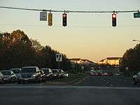 Germantown .jpg) Silver Spring | ||||
| 2 | Columbia | Howard | 99,615 | ||||||
| 3 | Germantown | Montgomery | 86,395 | ||||||
| 4 | Silver Spring | Montgomery | 71,452 | ||||||
| 5 | Waldorf | Charles | 67,752 | ||||||
| 6 | Glen Burnie | Anne Arundel | 67,639 | ||||||
| 7 | Ellicott City | Howard | 65,834 | ||||||
| 8 | Frederick | Frederick | 65,239 | ||||||
| 9 | Dundalk | Baltimore | 63,597 | ||||||
| 10 | Rockville | Montgomery | 61,209 | ||||||