Waugoshance Light
 Waugoshance in 2015 | |
 | |
| Location | Lake Michigan |
|---|---|
| Coordinates | 45°47′10″N 85°5′28″W / 45.78611°N 85.09111°WCoordinates: 45°47′10″N 85°5′28″W / 45.78611°N 85.09111°W |
| Year first constructed | 1850 |
| Year first lit | 1851 |
| Deactivated | 1912[1] |
| Foundation | Timber crib filled with stone/concrete |
| Construction | Brick encased with steel or iron boilerplate[2][3] |
| Tower shape | Frustum of a cone (encased in iron in 1883) |
| Markings / pattern | Natural |
| Height | 63 feet (19 m)[4][5] |
| Focal height | 74 feet (23 m)[6] |
| Original lens | Fourth order Fresnel lens[7] |
| Current lens | Removed |
| Characteristic | Original: Fog bell, Steam Whistle |
| ARLHS number |
USA-784[8] |
|
Waugoshance Light Station | |
| Nearest city | Waugoshance Island, Michigan |
| Area | 0.1 acres (0.040 ha) |
| MPS | U.S. Coast Guard Lighthouses and Light Stations on the Great Lakes TR |
| NRHP Reference # | 83000841[9] |
| Added to NRHP | August 04, 1983 |
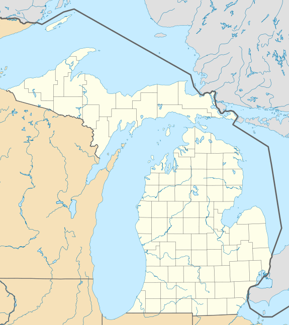
The lighthouse at Waugoshance protects boats from a shoal area at the northern end of Lake Michigan. The lighthouse is located in Emmet County, Michigan, United States, and in U.S. Coast Guard District No. 9.[10]
Reason for lighthouse
Boats from Chicago heading North (and ultimately) East need to navigate the narrow tip of northern Lake Michigan, and there are many dangers. The area around Waugoshance Point is not only shallow, it's a large (in area) projection from the bottom of the lake. Boats large enough to safely travel in times of storm cannot approach the light closer than a few hundred yards.
Adding to the complication of navigation in this area is the White Shoal, located just north of Waugoshance. This area is currently protected by White Shoal Light—built in 1912, nearby, powerful and larger—and Grays Reef Light which rendered this lighthouse obsolete.[11][12]
During the last half of the nineteenth century, this light marked the turning point for ships traveling through the Straits of Mackinac and along Lake Michigan's eastern shore between the mainland and the Beavers. With a water less than 12 feet (3.7 m) deep, it was "one of the most dangerous parts of the Straits." Thereafter, a "Gray's Reef passage" became more typical because modern freighters require considerably more depth, so Waugoshance is bypassed about 2 miles (3.2 km) to the west.[13]
History
In 1832 the first lightvessel on the Great Lakes was placed here.[14] That wooden lightship was the Lois McLain. In 1851 she was replaced by the Waugoshance Light, which stands in the area of the Wilderness State Park, and which remains one of the most hazardous areas near the Straits of Mackinac, Michigan.[11] The last light vessel on the Great Lakes was the Lightship Huron.
The lighthouse at Waugoshance was arguably the first light built in the Great Lakes that was totally surrounded by water. Both its construction and its continued maintenance were rendered extremely hazardous by the severe weather conditions of the area. Waugoshance is at the northern end of the long fetch of "south-wester" waves on Lake Michigan; the wave action is amplified as they build upon the shoal.[11]
The imposing crib structure was a first on the Great Lakes. The pier was reconstructed in 1870—a massive undertaking that was hampered by the ironic fact that the viable 'building season' is far shorter than even the normal operating season for the light—and used a "bird cage" lantern, which makes it one of only three built on the Great Lakes. The lantern originally held the first fourth order Fresnel lens on the Great Lakes.[11]
Although the light is now gray in color, it was originally painted in four broad horizontal Red and white stripes as a Daymark. Its walls were encased in steel, and are 5½ feet thick at the bottom.[15] The Waugoshance Light operated from 1851 until its deactivation in 1912, when it remained the property of the U.S. federal government. The encasement was similar to Big Sable Point Light, which was made from Cream City Brick, and also had to be encased in steel boilerplate to retard the deterioration.
Of particular note were the efforts of Lighthouse keepers who rang bells for many days, trying to ward mariners and their vessels off the shoal as they groped through the smoke from the many fires — 1871 Great Chicago Fire, Peshtigo Fire, Northern Michigan including large tracts around Manistee, Michigan, Western Michigan around Holland and the fire in the Thumb near Port Huron[16]—that took place beginning October 8, 1871, casting an impenetrable pall across Lake Michigan for the better part of a week. However, many vessels were lost.[17]
During World War II, the abandoned light was used by the U.S. Navy for bombing practice.[18] The Lighthouse keeper's house and all of the wood framing in the lighthouse burnt. The metal shell has fallen away.[11] Today, the lighthouse "is considered one of the most endangered lighthouses in the world."[18] It has been said that, ". . . . it is amazing that anything remains."[19]
Current status
The light is listed on the National Register, Reference #83000841, Name of Listing: WAUGOSHANCE LIGHT STATION (U.S. COAST GUARD/GREAT LAKES TR) It is not on the state list inventory.[12]
It is said to be both a "nautical gravestone" (because of the many wrecks in the vicinity) and on the "most endangered list" of lighthouses,[20] being on the Lighthouse Digest "Doomsday List." It is one of six in Michigan; the remaining five are: Charity Island Light, Fourteen Mile Point Light, Gull Rock Light, Manitou Island Light and Poverty Island Light.[21]
The Waugoshance Lighthouse Preservation Society was formed in 2000. It has undertaken preservation and restoration.[22] The Society's "first priority is raising funds to stabilize the building."[23] It is soliciting funds to rebuild the light, and is seeking an extended lease from the U.S. Coast Guard, so that restoration can continue.[18] In 2009, under the terms of the National Historic Lighthouse Preservation Act the lighthouse was put up for public sale.[24] Another source reports, however, that "In 2009, [it was] deemed excess by the U.S. Coast Guard," so it was "offered at no cost to eligible entities, including federal, state, and local agencies, non-profit corporations, and educational organizations under the provisions of the National Historic Lighthouse Preservation Act of 2000."[25]
Getting there
The lighthouse is closed to the public.
A private boat is recommended to see this light close up. These are, however, dangerous and open water over wide expanses far from shore and interlaced by shoals, so caution is advised.[23]
Short of that, Shepler's Ferry Service out of Mackinaw City offers periodic lighthouse cruises in the summer season. Its "westbound Lighthouse Tour"—three hours more or less—includes passes by various lights, including Waugoshance Light, White Shoal Light, Wilderness State Park, Gray's Reef Light (originally built in 1891), and St. Helena Island Light. Schedules and rates are available from Shepler's.[26]
Another alternative is to charter a seaplane to make a tour of the Mackinac Straits and environs.[27]
References
- ↑ Lighthouse Central, Photographs, History, Directions and Way points for Waugoshance Light, The Ultimate Guide to West Michigan Lighthouses by Jerry Roach (Publisher: Bugs Publishing LLC - 2005). ISBN 0-9747977-0-7. Archived August 27, 2009, at the Wayback Machine.
- ↑ However, other sources say it is "iron"boiler plate. See Michigan Lighthouse Project, Waugoshance Light.
- ↑ "Detroit News, Interactive map on Michigan lighthouses.".
- ↑ Pepper, Terry. "Database of Tower Heights". Seeing the Light. terrypepper.com.
- ↑ "Michigan Lighthouse Conservancy, Waugoshance Light.".
- ↑ Pepper, Terry. "Database of Focal Heights". Seeing the Light. terrypepper.com.
- ↑ Pepper, Terry. "Database of Original Lenses". Seeing the Light. terrypepper.com.
- ↑ "Amateur Radio Lighthouse Society, USA-784, Waugoshance Light (Lake Michigan).".
- ↑ National Park Service (2009-03-13). "National Register Information System". National Register of Historic Places. National Park Service.
- ↑ "Michigan Lighthouse conservancy, Waugoshance Light.".
- 1 2 3 4 5 "Terry Pepper, Seeing The Light, Waugoshance Lighthouse.".
- 1 2 National Park Service Maritime History, Inventory of Historic Light Stations, Waugoshance Shoal Light.
- ↑ Edwards, Jack, "A Nautical Gravestone", Great Lakes Cruiser Magazine (October, 1994) reprinted in Lighthouse Digest. Archived June 14, 2011, at the Wayback Machine.
- ↑ "Wagner, John L., Chronology of Michigan lightship and lighthouses Beacons Shining in the Night, Clarke Historical Library, Central, Michigan University.".
- ↑ "Waugoshance Lighthouse Preservation Society, "Our Lighthouse".".
- ↑ "Manistee Michigan history page.".
- ↑ Edwards, Jack, "A Nautical Gravestone", Great Lakes Cruiser Magazine (October, 1994) reprinted in Lighthouse Digest. Archived June 14, 2011, at the Wayback Machine.
- 1 2 3 "Waugoshance Lighthouse Preservation Society.".
- ↑ "Wobser, David, Waugoshance Light, boatnerd.com.".
- ↑ "Edwards, Jack, A Nautical Gravestone, Great Lakes Cruiser Magazine (October, 1994) Lighthouse Digest.". Archived from the original on June 14, 2011.
- ↑ Rowlett, Russ. "The Doomsday List". The Lighthouse Directory. University of North Carolina at Chapel Hill.
- ↑ "Terry Pepper, Seeing the Light, Waugoshance Shoal Light.".
- 1 2 Rowlett, Russ. "Lighthouses of the United States: Michigan's Western Lower Peninsula". The Lighthouse Directory. University of North Carolina at Chapel Hill.
- ↑ "NHLPA 2009 Program, Notices of Availability". www.nps.gov. Retrieved June 6, 2009.
- ↑ "Lighthouses in the Mackinac Straits, Lighthouse Friends, including a winter aerial photograph.".
- ↑ "Shepler's Ferry Service.".
- ↑ Stoke, Keith, A seaplane tour of the Straits.
Further reading
- "A Tour of the Lights of the Straits." Michigan History 70 (Sep/Oct 1986), pp. 17–29.
- Wagner, John L. "Beacons Shining in the Night: The Lighthouses of Michigan". Clarke Historical Library, Central Michigan University.
External links
- Aerial photos, Waugoshance Light, marinas.com.
- Interactive map of Lights in Northern Lake Michigan, Google maps.
- "Historic Light Station Information and Photography: Michigan". United States Coast Guard Historian's Office. Waugoshance Shoal Light.
- Waugoshance Lighthouse Preservation Society.
| Northern Upper Peninsula |
|  |
|---|---|---|
| Southern Upper Peninsula | ||
| St. Mary's River |
| |
| Portage River/Ship Canal |
| |
| Straits of Mackinac | ||
| Western Lower Peninsula |
| |
| Eastern Lower Peninsula |
| |
| Historical (lost) lights |
| |
| Related | ||
| Lists by county |
|   |
|---|---|---|
| Other lists |
| |