Wellsville, Kansas
| Wellsville, Kansas | |
|---|---|
| City | |
| Motto: "Proud Past - Growing Future" | |
 Location within Franklin County and Kansas | |
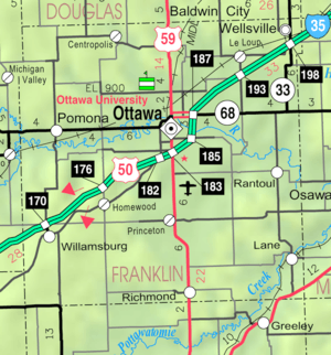 KDOT map of Franklin County (legend) | |
| Coordinates: 38°43′11″N 95°4′53″W / 38.71972°N 95.08139°WCoordinates: 38°43′11″N 95°4′53″W / 38.71972°N 95.08139°W | |
| Country | United States |
| State | Kansas |
| County | Franklin |
| Platted | 1872 |
| Incorporated | 1884 |
| Government | |
| • Type | Mayor–Council |
| • Mayor | Bill Lytle |
| Area[1] | |
| • Total | 1.40 sq mi (3.63 km2) |
| • Land | 1.39 sq mi (3.60 km2) |
| • Water | 0.01 sq mi (0.03 km2) |
| Elevation | 1,040 ft (317 m) |
| Population (2010)[2] | |
| • Total | 1,857 |
| • Estimate (2012[3]) | 1,845 |
| • Density | 1,300/sq mi (510/km2) |
| Time zone | Central (CST) (UTC-6) |
| • Summer (DST) | CDT (UTC-5) |
| ZIP code | 66092 |
| Area code(s) | 785 |
| FIPS code | 20-76625 |
| GNIS feature ID | 0479383 [4] |
| Website | CityOfWellsvilleKS.org |
Wellsville is a city in Franklin County, Kansas, United States. As of the 2010 census, the city population was 1,857.[5]
History
Wellsville was platted in 1870.[6][7] The town was named after D.L. Wells, a railroad construction engineer.[8][9]
The first post office in Wellsville was established in October 1870.[10]
In 1893, baseball star Charlie Bennett went hunting with pitcher John Clarkson. Bennett got off the train in Wellsville to speak to an acquaintance; when he tried to reboard, he slipped and fell under the train's wheels. Bennett lost both legs in the accident. He was fitted with artificial limbs but his baseball career was over; he lived until 1927.
Geography
Wellsville is located at 38°43′11″N 95°4′53″W / 38.71972°N 95.08139°W (38.719694, -95.081358).[11] According to the United States Census Bureau, the city has a total area of 1.40 square miles (3.63 km2), of which 1.39 square miles (3.60 km2) is land and 0.01 square miles (0.03 km2) is water.[1]
Demographics
| Historical population | |||
|---|---|---|---|
| Census | Pop. | %± | |
| 1880 | 143 | — | |
| 1890 | 392 | 174.1% | |
| 1900 | 447 | 14.0% | |
| 1910 | 648 | 45.0% | |
| 1920 | 756 | 16.7% | |
| 1930 | 709 | −6.2% | |
| 1940 | 632 | −10.9% | |
| 1950 | 729 | 15.3% | |
| 1960 | 984 | 35.0% | |
| 1970 | 1,183 | 20.2% | |
| 1980 | 1,612 | 36.3% | |
| 1990 | 1,563 | −3.0% | |
| 2000 | 1,606 | 2.8% | |
| 2010 | 1,857 | 15.6% | |
| Est. 2015 | 1,818 | [12] | −2.1% |
| U.S. Decennial Census[13] 2012 Estimate[14] | |||
2010 census
As of the census[2] of 2010, there were 1,857 people, 722 households, and 500 families residing in the city. The population density was 1,336.0 inhabitants per square mile (515.8/km2). There were 780 housing units at an average density of 561.2 per square mile (216.7/km2). The racial makeup of the city was 95.6% White, 0.7% African American, 0.6% Native American, 0.2% Asian, 0.6% from other races, and 2.4% from two or more races. Hispanic or Latino of any race were 3.2% of the population.
There were 722 households of which 38.2% had children under the age of 18 living with them, 50.0% were married couples living together, 12.3% had a female householder with no husband present, 6.9% had a male householder with no wife present, and 30.7% were non-families. 26.3% of all households were made up of individuals and 12.5% had someone living alone who was 65 years of age or older. The average household size was 2.52 and the average family size was 3.02.
The median age in the city was 35.4 years. 27.8% of residents were under the age of 18; 7% were between the ages of 18 and 24; 29.3% were from 25 to 44; 22.6% were from 45 to 64; and 13.3% were 65 years of age or older. The gender makeup of the city was 48.5% male and 51.5% female.
2000 census
As of the census of 2000, there were 1,606 people, 636 households, and 435 families residing in the city. The population density was 1,917.2 people per square mile (738.2/km²). There were 666 housing units at an average density of 795.1 per square mile (306.1/km²). The racial makeup of the city was 98.13% White, 0.19% African American, 0.50% Native American, 0.06% Asian, 0.06% from other races, and 1.06% from two or more races. Hispanic or Latino of any race were 0.75% of the population.
There were 636 households out of which 37.3% had children under the age of 18 living with them, 53.3% were married couples living together, 9.9% had a female householder with no husband present, and 31.6% were non-families. 28.9% of all households were made up of individuals and 13.5% had someone living alone who was 65 years of age or older. The average household size was 2.45 and the average family size was 3.02.
In the city the population was spread out with 28.6% under the age of 18, 8.0% from 18 to 24, 30.3% from 25 to 44, 19.2% from 45 to 64, and 14.0% who were 65 years of age or older. The median age was 34 years. For every 100 females there were 93.7 males. For every 100 females age 18 and over, there were 88.7 males.
The median income for a household in the city was $38,456, and the median income for a family was $47,102. Males had a median income of $35,938 versus $25,250 for females. The per capita income for the city was $18,215. About 7.9% of families and 7.9% of the population were below the poverty line, including 7.6% of those under age 18 and 13.4% of those age 65 or over.
Education
The city of Wellsville is served by Wellsville School District USD 289, which operates three separate schools:
- Wellsville High School
- Wellsville Middle School
- Wellsville Elementary School
Notable people
- Bill Grigsby, sportscaster.
- Elizabeth "Grandma" Layton, artist.[15]
- Chely Wright, singer, Academy of Country Music award-winning artist.
References
- 1 2 "US Gazetteer files 2010". United States Census Bureau. Retrieved 2012-07-06.
- 1 2 "American FactFinder". United States Census Bureau. Retrieved 2012-07-06.
- ↑ "Population Estimates". United States Census Bureau. Retrieved 2013-05-29.
- ↑ "US Board on Geographic Names". United States Geological Survey. 2007-10-25. Retrieved 2008-01-31.
- ↑ "2010 City Population and Housing Occupancy Status". U.S. Census Bureau. Retrieved April 4, 2012.
- ↑ Blackmar, Frank Wilson (1912). Kansas: A Cyclopedia of State History, Volume 2. Standard Publishing Company. p. 900.
- ↑ Kansas State Historical Society (1916). Biennial Report of the Board of Directors of the Kansas State Historical Society. Kansas State Printing Plant. p. 192.
- ↑ Wellsville Information
- ↑ Carpenter, Tim (November 28, 1997). "What's in a name? Key elements of area history". Lawrence Journal-World. pp. 3B. Retrieved 28 April 2015.
- ↑ "Kansas Post Offices, 1828-1961 (archived)". Kansas Historical Society. Archived from the original on October 9, 2013. Retrieved 10 June 2014.
- ↑ "US Gazetteer files: 2010, 2000, and 1990". United States Census Bureau. 2011-02-12. Retrieved 2011-04-23.
- ↑ "Annual Estimates of the Resident Population for Incorporated Places: April 1, 2010 to July 1, 2015". Retrieved July 2, 2016.
- ↑ United States Census Bureau. "Census of Population and Housing". Retrieved October 23, 2013.
- ↑ "Annual Estimates of the Resident Population: April 1, 2010 to July 1, 2012". Retrieved October 23, 2013.
- ↑ http://elizabethlayton.com
External links
| Wikimedia Commons has media related to Wellsville, Kansas. |
- City
- Schools
- USD 289, local school district
- Maps
- Wellsville City Map, KDOT
Municipalities and communities of Franklin County, Kansas, United States | ||
|---|---|---|
| Cities | 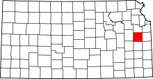 | |
| Unincorporated communities | ||
| Ghost towns | ||
| Townships | ||