West Peoria Township, Peoria County, Illinois
| West Peoria Township | |
|---|---|
| Township | |
 Location in Peoria County | |
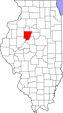
 Peoria County's location in Illinois | |
| Coordinates: 40°42′N 89°38′W / 40.700°N 89.633°WCoordinates: 40°42′N 89°38′W / 40.700°N 89.633°W | |
| Country | United States |
| State | Illinois |
| County | Peoria |
| Established | November 6, 1849 |
| Government | |
| • Supervisor | Allan Rosberg |
| Area | |
| • Total | 3.54 sq mi (9.2 km2) |
| • Land | 3.36 sq mi (8.7 km2) |
| • Water | 0.18 sq mi (0.5 km2) 5.08% |
| Population (2010) | |
| • Total | 4,458 |
| Time zone | CST (UTC-6) |
| • Summer (DST) | CDT (UTC-5) |
West Peoria Township is located in Peoria County, Illinois. As of the 2010 census, its population was 4,458 and it contained 2,123 housing units.[1] West Peoria was the portion of Peoria Township that was left when the City of Peoria Township was formed in 1907. It has two parts: the northern, most of which also became the city of West Peoria, Illinois in 1993; and the southern, a triangle between Bartonville, Peoria, and the Illinois River, and including part of Bartonville.
Geography
According to the 2010 census, the township has a total area of 3.54 square miles (9.2 km2), of which 3.36 square miles (8.7 km2) (or 94.92%) is land and 0.18 square miles (0.47 km2) (or 5.08%) is water.[1]
References
- 1 2 "Population, Housing Units, Area, and Density: 2010 - County -- County Subdivision and Place -- 2010 Census Summary File 1". United States Census. Retrieved 2013-05-28.
External links
This article is issued from Wikipedia - version of the 9/4/2016. The text is available under the Creative Commons Attribution/Share Alike but additional terms may apply for the media files.
