Adel, Georgia
| Adel, Georgia | |
|---|---|
| City | |
|
Adel City Hall, 2012 | |
 Location in Cook County and the state of Georgia | |
| Coordinates: 31°8′18″N 83°25′33″W / 31.13833°N 83.42583°WCoordinates: 31°8′18″N 83°25′33″W / 31.13833°N 83.42583°W | |
| Country | United States |
| State | Georgia |
| County | Cook |
| Government | |
| • Mayor | Buddy Duke |
| Area | |
| • Total | 8.2 sq mi (21.3 km2) |
| • Land | 8.1 sq mi (20.9 km2) |
| • Water | 0.2 sq mi (0.5 km2) |
| Elevation | 240 ft (73 m) |
| Population (2010)[1] | |
| • Total | 5,334 |
| • Density | 662/sq mi (255.6/km2) |
| Time zone | Eastern (EST) (UTC-5) |
| • Summer (DST) | EDT (UTC-4) |
| ZIP code | 31620 |
| Area code(s) | 229 |
| FIPS code | 13-00576[2] |
| GNIS feature ID | 0354262[3] |
| Website |
www |

The city of Adel is the county seat of Cook County, Georgia, United States.[4] As of the 2010 census, the city had a population of 5,344.[5]
History
The original name of the city was Puddleville.[6] The city's first postmaster, Joel "Uncle Jack" Parrish, wanted to change the name of the city. It is believed that he saw the name "Philadelphia" on a croaker sack and struck out the first and last four letters to create the present name of Adel.[7]
The Georgia Southern and Florida Railway arrived into Adel in the 1880s. Adel was incorporated as a town in 1889.[8]
Geography
Adel is located just south of the center of Cook County at 31°8′18″N 83°25′33″W / 31.13833°N 83.42583°W (31.138466, -83.425944).[9] It is bordered to the north by Sparks. U.S. Route 41 passes through the center of town as Hutchinson Avenue, and Interstate 75 passes through the western side of the city, with access from Exit 39. Valdosta is 26 miles (42 km) to the south, and Tifton is 23 miles (37 km) to the north.
According to the United States Census Bureau, Adel has a total area of 8.2 square miles (21.3 km2), of which 8.1 square miles (20.9 km2) is land and 0.19 square miles (0.5 km2), or 2.21%, is water.[10]
Demographics
| Historical population | |||
|---|---|---|---|
| Census | Pop. | %± | |
| 1890 | 527 | — | |
| 1900 | 721 | 36.8% | |
| 1910 | 1,902 | 163.8% | |
| 1920 | 1,720 | −9.6% | |
| 1930 | 1,796 | 4.4% | |
| 1940 | 2,134 | 18.8% | |
| 1950 | 2,776 | 30.1% | |
| 1960 | 4,321 | 55.7% | |
| 1970 | 4,972 | 15.1% | |
| 1980 | 5,592 | 12.5% | |
| 1990 | 5,093 | −8.9% | |
| 2000 | 5,307 | 4.2% | |
| 2010 | 5,334 | 0.5% | |
| Est. 2015 | 5,316 | [11] | −0.3% |
As of the census[2] of 2000, there were 5,307 people, 1,958 households, and 1,335 families residing in the city. The population density was 674.1 people per square mile (260.4/km²). There were 2,164 housing units at an average density of 274.9 per square mile (106.2/km²). The racial makeup of the city was 47.97% White, 48.92% African American, 0.08% Native American, 0.75% Asian, 0.09% Pacific Islander, 1.43% from other races, and 0.75% from two or more races. Hispanic or Latino of any race were 3.79% of the population.
There were 1,958 households out of which 33.9% had children under the age of 18 living with them, 43.0% were married couples living together, 20.8% had a female householder with no husband present, and 31.8% were non-families. 27.9% of all households were made up of individuals and 12.3% had someone living alone who was 65 years of age or older. The average household size was 2.60 and the average family size was 3.17.
In the city the population was spread out with 29.4% under the age of 18, 9.4% from 18 to 24, 26.1% from 25 to 44, 20.0% from 45 to 64, and 15.2% who were 65 years of age or older. The median age was 34 years. For every 100 females there were 86.3 males. For every 100 females age 18 and over, there were 83.5 males.
The median income for a household in the city was $23,908, and the median income for a family was $27,318. Males had a median income of $25,927 versus $19,688 for females. The per capita income for the city was $13,425. About 23.5% of families and 27.4% of the population were below the poverty line, including 36.6% of those under age 18 and 29.2% of those age 65 or over.
Education
Cook County School District
The Cook County School District holds pre-school to grade twelve, and consists of two elementary schools, a middle school, and a high school.[13] The district has 188 full-time teachers and over 3,215 students.[14]
- Cook Primary School
- Cook Elementary School
- Cook Middle School
- Cook High School
Library
Adel is served by the Cook County Public Library.[15]
Climate
The climate in this area is characterized by relatively high temperatures and evenly distributed precipitation throughout the year. According to the Köppen Climate Classification system, Adel has a Humid subtropical climate, abbreviated "Cfa" on climate maps.[16]
References
- ↑ "American FactFinder". United States Census Bureau. Archived from the original on 2013-09-11. Retrieved 2011-05-14.
- 1 2 "American FactFinder". United States Census Bureau. Archived from the original on 2013-09-11. Retrieved 2008-01-31.
- ↑ "US Board on Geographic Names". United States Geological Survey. 2007-10-25. Retrieved 2008-01-31.
- ↑ "Find a County". National Association of Counties. Archived from the original on 2011-05-31. Retrieved 2011-06-07.
- ↑ http://factfinder2.census.gov/faces/tableservices/jsf/pages/productview.xhtml?pid=DEC_10_SF1_GCTP2.ST13&prodType=table
- ↑ Krakow, Kenneth K. (1975). Georgia Place-Names. Winship Press, ISBN 9780915430000
- ↑ http://adel.georgia.gov/05/home/0,2230,8609945,00.html;jsessionid=35E30CF21EFAA2F7AFC46E4C6E2A56A8
- ↑ Hellmann, Paul T. (May 13, 2013). Historical Gazetteer of the United States. Routledge. p. 215. Retrieved 30 November 2013.
- ↑ "US Gazetteer files: 2010, 2000, and 1990". United States Census Bureau. 2011-02-12. Retrieved 2011-04-23.
- ↑ "Geographic Identifiers: 2010 Demographic Profile Data (G001): Adel city, Georgia". U.S. Census Bureau, American Factfinder. Retrieved July 30, 2014.
- ↑ "Annual Estimates of the Resident Population for Incorporated Places: April 1, 2010 to July 1, 2015". Retrieved July 2, 2016.
- ↑ "Census of Population and Housing". Census.gov. Archived from the original on May 11, 2015. Retrieved June 4, 2015.
- ↑ Georgia Board of Education, Retrieved June 5, 2010.
- ↑ School Stats, Retrieved June 5, 2010.
- ↑ "Homepage". Cook County Public Library. Retrieved 30 July 2014.
- ↑ Climate Summary for Adel, Georgia
External links
- City of Adel official website
- Adel Lime Sink historical marker
Municipalities and communities of Cook County, Georgia, United States | ||
|---|---|---|
| City | 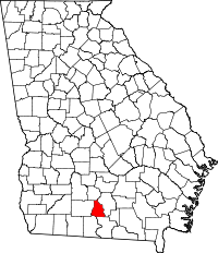 | |
| Towns | ||