Ashford, New York
| Ashford, New York | |
|---|---|
| Town | |
 Ashford Location within the state of New York | |
| Coordinates: 42°26′47″N 78°39′10″W / 42.44639°N 78.65278°W | |
| Country | United States |
| State | New York |
| County | Cattaraugus |
| Government | |
| • Type | Town Council |
| • Town Supervisor | Christopher Gerwitz (R) |
| • Town Council |
Members' List
|
| Area | |
| • Total | 51.9 sq mi (134.4 km2) |
| • Land | 51.7 sq mi (134.0 km2) |
| • Water | 0.2 sq mi (0.4 km2) |
| Elevation | 1,381 ft (421 m) |
| Population (2010) | |
| • Total | 2,132 |
| • Density | 41/sq mi (15.9/km2) |
| Time zone | Eastern (EST) (UTC-5) |
| • Summer (DST) | EDT (UTC-4) |
| FIPS code | 36-02759 |
| GNIS feature ID | 0978690 |
| Website |
ashfordny |
Ashford is a town in Cattaraugus County, New York, United States. The population was 2,132 at the 2010 census.[1] The town is on the county's northern border.
History
The town was first settled around 1816, and was founded in 1824 by Henry Frank, Sr., a Revolutionary War veteran from Philadelphia.
Geography
According to the United States Census Bureau, the town has a total area of 51.9 square miles (134.4 km2), of which 51.7 square miles (134.0 km2) is land and 0.15 square miles (0.4 km2), or 0.32%, is water.[1]
The north boundary is formed by Cattaraugus Creek, and the north town line is the border of Erie County.
New York State Route 240, a north-south route in the eastern part of the town, links the town to the suburbs of Buffalo, as does U.S. Route 219 in the western part of the town.
Adjacent towns and areas
The northern border is formed with the towns of Concord and Sardinia in Erie County, and the south border is created by the towns of Ellicottville and East Otto. To the west is the town of East Otto. The east boundary is formed by the towns of Machias and Yorkshire.
Demographics
| Historical population | |||
|---|---|---|---|
| Census | Pop. | %± | |
| 1830 | 631 | — | |
| 1840 | 1,469 | 132.8% | |
| 1850 | 1,658 | 12.9% | |
| 1860 | 1,975 | 19.1% | |
| 1870 | 1,801 | −8.8% | |
| 1880 | 1,813 | 0.7% | |
| 1890 | 1,710 | −5.7% | |
| 1900 | 1,645 | −3.8% | |
| 1910 | 1,557 | −5.3% | |
| 1920 | 1,379 | −11.4% | |
| 1930 | 1,214 | −12.0% | |
| 1940 | 1,340 | 10.4% | |
| 1950 | 1,370 | 2.2% | |
| 1960 | 1,490 | 8.8% | |
| 1970 | 1,577 | 5.8% | |
| 1980 | 1,922 | 21.9% | |
| 1990 | 2,162 | 12.5% | |
| 2000 | 2,223 | 2.8% | |
| 2010 | 2,132 | −4.1% | |
| Est. 2014 | 2,095 | [2] | −1.7% |
As of the census[4] of 2000, there were 2,223 people, 857 households, and 634 families residing in the town. The population density was 43.3 people per square mile (16.7/km²). There were 1,023 housing units at an average density of 19.9 per square mile (7.7/km²). The racial makeup of the town was 96.99% White, 1.53% African American, 0.54% Native American, 0.18% Asian, 0.09% from other races, and 0.67% from two or more races. Hispanic or Latino of any race were 0.76% of the population.
There were 857 households out of which 33.6% had children under the age of 18 living with them, 61.7% were married couples living together, 8.3% had a female householder with no husband present, and 26.0% were non-families. 21.5% of all households were made up of individuals and 7.6% had someone living alone who was 65 years of age or older. The average household size was 2.59 and the average family size was 3.03.
In the town the population was spread out with 26.8% under the age of 18, 5.7% from 18 to 24, 28.7% from 25 to 44, 27.1% from 45 to 64, and 11.7% who were 65 years of age or older. The median age was 38 years. For every 100 females there were 98.3 males. For every 100 females age 18 and over, there were 98.5 males.
The median income for a household in the town was $41,313, and the median income for a family was $44,509. Males had a median income of $32,392 versus $21,500 for females. The per capita income for the town was $19,136. About 4.0% of families and 6.3% of the population were below the poverty line, including 5.9% of those under age 18 and 6.5% of those age 65 or over.
Communities and locations in Ashford
- Ashford Hollow – A hamlet in the southwest part of the town on U.S. Route 219.
- Ashford Junction – A railroad junction built in the early 1880s by the Buffalo, Rochester and Pittsburgh Railway
- Beaver Siding – A location in the southeast corner of the town, located on County Road 60 and south of West Valley.
- Bellow Corners – A hamlet east of Ashford Hollow, located on County Road 85.
- Buttermilk Creek – A tributary of Cattaraugus Creek in the north part of the town.
- Edies Siding – A hamlet in the northwest corner of the town by Cattaraugus Creek.
- Fox – A hamlet near the center of the town, east of Ashford Hollow.
- Riceville (also called "East Ashford") – A hamlet near the east town line on County Road 55.
- Riceville Station – A location west of Riceville on Route 240.
- Scoby Power Plant and Dam – A former hydroelectric dam along Cattaraugus Creek on the northern border of the town.
- Thomas Corners – A hamlet in the northeast part of the town on Route 240.
- West Valley – A hamlet and census-designated place in the southeast part of the town at the junction of Routes 53 and 240.
- West Valley Demonstration Project – A United States Department of Energy nuclear processing station.
References
- 1 2 "Geographic Identifiers: 2010 Demographic Profile Data (G001): Ashford town, Cattaraugus County, New York". U.S. Census Bureau, American Factfinder. Retrieved October 23, 2014.
- ↑ "Annual Estimates of the Resident Population for Incorporated Places: April 1, 2010 to July 1, 2014". Retrieved June 4, 2015.
- ↑ "Census of Population and Housing". Census.gov. Archived from the original on May 11, 2015. Retrieved June 4, 2015.
- ↑ "American FactFinder". United States Census Bureau. Archived from the original on 2013-09-11. Retrieved 2008-01-31.
External links
Municipalities and communities of Cattaraugus County, New York, United States | ||
|---|---|---|
| Cities | 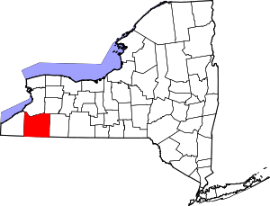 | |
| Towns |
| |
| Villages | ||
| CDPs | ||
| Other hamlets | ||
| Indian reservations | ||
| Footnotes |
| |
Coordinates: 42°19′13″N 78°36′29″W / 42.32028°N 78.60806°W