Humphrey, New York
| Humphrey, New York | |
|---|---|
| Town | |
 Humphrey Location within the state of New York | |
| Coordinates: 42°12′42″N 78°31′17″W / 42.21167°N 78.52139°W | |
| Country | United States |
| State | New York |
| County | Cattaraugus |
| Government | |
| • Type | Town Council |
| • Town Supervisor | Carrie L. Childs (R) |
| • Town Council |
Members' List
|
| Area | |
| • Total | 37.15 sq mi (96.23 km2) |
| • Land | 37.14 sq mi (96.18 km2) |
| • Water | 0.02 sq mi (0.04 km2) |
| Elevation | 1,841 ft (561 m) |
| Population (2010) | |
| • Total | 687 |
| • Density | 18.5/sq mi (7.14/km2) |
| Time zone | Eastern (EST) (UTC-5) |
| • Summer (DST) | EDT (UTC-4) |
| ZIP code | 14741 |
| Area code(s) | 716 |
| FIPS code | 36-36123 |
| GNIS feature ID | 0979085 |
| Website |
humphreytownship |
Humphrey is a town in Cattaraugus County, New York, United States. The population was 687 at the 2010 census.[1] The town is named after Charles Humphrey, who at the time of the town's founding was Speaker of the New York State Assembly.[2]
Humphrey is an interior town in the eastern half of the county, northeast of the city of Salamanca.
History
The area that would become the town was first settled around 1815. The town of Humphrey was established in 1836 from a part of the town of Allegany.
Geography
According to the United States Census Bureau, the town has a total area of 37.1 square miles (96.2 km2), of which 0.02 square miles (0.04 km2), or 0.05%, is water.[1]
New York State Route 98 crosses the northwest corner of the town. Humphrey is primarily served by county roads, namely Routes 18, 19, and 51.
Adjacent towns and areas
Humphrey is east of the town of Great Valley and south of the town of Franklinville. The east town line is shared by the towns of Hinsdale and Ischua. To the south is the town of Allegany.
Demographics
| Historical population | |||
|---|---|---|---|
| Census | Pop. | %± | |
| 1840 | 444 | — | |
| 1850 | 824 | 85.6% | |
| 1860 | 963 | 16.9% | |
| 1870 | 1,065 | 10.6% | |
| 1880 | 997 | −6.4% | |
| 1890 | 866 | −13.1% | |
| 1900 | 794 | −8.3% | |
| 1910 | 626 | −21.2% | |
| 1920 | 531 | −15.2% | |
| 1930 | 526 | −0.9% | |
| 1940 | 424 | −19.4% | |
| 1950 | 367 | −13.4% | |
| 1960 | 415 | 13.1% | |
| 1970 | 405 | −2.4% | |
| 1980 | 529 | 30.6% | |
| 1990 | 580 | 9.6% | |
| 2000 | 721 | 24.3% | |
| 2010 | 687 | −4.7% | |
| Est. 2014 | 669 | [3] | −2.6% |
As of the census[5] of 2000, there were 721 people, 263 households, and 186 families residing in the town. The population density was 19.7 people per square mile (7.6/km²). There were 457 housing units at an average density of 12.5 per square mile (4.8/km²). The racial makeup of the town was 97.23% White, 0.97% African American, 0.83% Native American, 0.69% from other races, and 0.28% from two or more races. Hispanic or Latino of any race were 0.83% of the population.
There were 263 households out of which 37.6% had children under the age of 18 living with them, 56.7% were married couples living together, 7.6% had a female householder with no husband present, and 28.9% were non-families. 22.1% of all households were made up of individuals and 9.5% had someone living alone who was 65 years of age or older. The average household size was 2.74 and the average family size was 3.22.
In the town the population was spread out with 27.6% under the age of 18, 8.6% from 18 to 24, 28.6% from 25 to 44, 24.1% from 45 to 64, and 11.1% who were 65 years of age or older. The median age was 36 years. For every 100 females there were 107.8 males. For every 100 females age 18 and over, there were 109.6 males.
The median income for a household in the town was $35,313, and the median income for a family was $35,795. Males had a median income of $27,768 versus $20,326 for females. The per capita income for the town was $16,874. About 9.2% of families and 11.3% of the population were below the poverty line, including 14.4% of those under age 18 and 8.5% of those age 65 or over.
Communities and locations in Humphrey
- Humphrey – The hamlet of Humphrey is near the center of the town at the junction of County Roads 18 and 51. It was formerly known as "Chapellsburg" after an early hotel owner.
- Humphrey Center – A hamlet in the northern part of the town on County Road 18. The community is locally called "Tickletown"; more about Tickletown can be found here.
- Wrights Creek – A stream flowing past Humphrey and Humphrey Center. It is named after early settler Richard Wright.
- Pumpkinville – An autumn theme park, pumpkin patch and apple cider mill based in the western part of the town.
References
- 1 2 "Geographic Identifiers: 2010 Demographic Profile Data (G001): Humphrey town, Cattaraugus County, New York". U.S. Census Bureau, American Factfinder. Retrieved October 27, 2014.
- ↑ Gannett, Henry (1905). The Origin of Certain Place Names in the United States. Govt. Print. Off. p. 163.
- ↑ "Annual Estimates of the Resident Population for Incorporated Places: April 1, 2010 to July 1, 2014". Retrieved June 4, 2015.
- ↑ "Census of Population and Housing". Census.gov. Archived from the original on May 11, 2015. Retrieved June 4, 2015.
- ↑ "American FactFinder". United States Census Bureau. Archived from the original on September 11, 2013. Retrieved 2008-01-31.
External links
Municipalities and communities of Cattaraugus County, New York, United States | ||
|---|---|---|
| Cities | 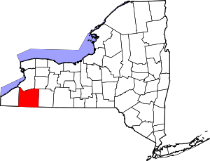 | |
| Towns |
| |
| Villages | ||
| CDPs | ||
| Other hamlets | ||
| Indian reservations | ||
| Footnotes |
| |
Coordinates: 42°12′20″N 78°32′21″W / 42.20556°N 78.53917°W