Avery Township, Hancock County, Iowa
| Avery Township | |
|---|---|
| Township | |
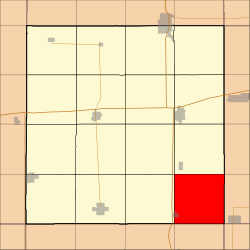 Location in Hancock County | |
| Coordinates: 42°56′49″N 93°33′46″W / 42.94694°N 93.56278°WCoordinates: 42°56′49″N 93°33′46″W / 42.94694°N 93.56278°W | |
| Country |
|
| State |
|
| County | Hancock |
| Area | |
| • Total | 35.88 sq mi (92.94 km2) |
| • Land | 35.84 sq mi (92.82 km2) |
| • Water | 0.04 sq mi (0.11 km2) 0.12% |
| Elevation | 1,247 ft (380 m) |
| Population (2000) | |
| • Total | 387 |
| • Density | 10.8/sq mi (4.2/km2) |
| Time zone | CST (UTC-6) |
| • Summer (DST) | CDT (UTC-5) |
| ZIP codes | 50439, 50449, 50457 |
| GNIS feature ID | 0467404 |
Avery Township is one of sixteen townships in Hancock County, Iowa, USA. As of the 2000 census, its population was 387.[1]
History
Avery Township was named for Anson Avery, a pioneer settler.[2]
Geography
According to the United States Census Bureau, Avery Township covers an area of 35.88 square miles (92.94 square kilometers); of this, 35.84 square miles (92.82 square kilometers, 99.87 percent) is land and 0.04 square miles (0.11 square kilometers, 0.12 percent) is water.
Cities, towns, villages
- Goodell (east three-quarters)
Adjacent townships
- Ell Township (north)
- Union Township, Cerro Gordo County (northeast)
- Grimes Township, Cerro Gordo County (east)
- Wisner Township, Franklin County (southeast)
- Pleasant Township, Wright County (south)
- Belmond Township, Wright County (southwest)
- Twin Lake Township (west)
- Liberty Township (northwest)
Cemeteries
The township contains Amsterdam & Calvary Cemeteries.
Landmarks
- Eldred Sherwood Park
School districts
- Belmond-Klemme Community School District
- Sheffield Chapin Meservey Thornton Community School District
Political districts
- Iowa's 4th congressional district
- State House District 12
- State Senate District 6
References
- United States Census Bureau 2008 TIGER/Line Shapefiles
- United States Board on Geographic Names (GNIS)
- United States National Atlas
- ↑ United States Census Bureau American FactFinder
- ↑ History of Winnebago County and Hancock County, Iowa. Pioneer Publishing Company. 1917. p. 258.
External links
 |
Liberty Township | Ell Township | Union Township, Cerro Gordo County | |
| Twin Lake Township | |
Grimes Township, Cerro Gordo County | ||
| ||||
| | ||||
| Belmond Township, Wright County | Pleasant Township, Wright County | Wisner Township, Franklin County |
Municipalities and communities of Hancock County, Iowa, United States | ||
|---|---|---|
| Cities | ||
| Townships | ||
| CDPs | ||
| Other unincorporated communities | ||
| Footnotes | ‡This populated place also has portions in an adjacent county or counties | |
This article is issued from Wikipedia - version of the 10/24/2016. The text is available under the Creative Commons Attribution/Share Alike but additional terms may apply for the media files.