Orthel Township, Hancock County, Iowa
| Orthel Township | |
|---|---|
| Township | |
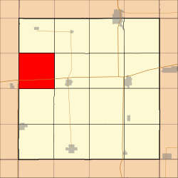 Location in Hancock County | |
| Coordinates: 43°07′39″N 93°54′49″W / 43.12750°N 93.91361°WCoordinates: 43°07′39″N 93°54′49″W / 43.12750°N 93.91361°W | |
| Country |
|
| State |
|
| County | Hancock |
| Area | |
| • Total | 35.84 sq mi (92.82 km2) |
| • Land | 35.77 sq mi (92.64 km2) |
| • Water | 0.07 sq mi (0.17 km2) 0.18% |
| Elevation | 1,250 ft (381 m) |
| Population (2000) | |
| • Total | 247 |
| • Density | 6.9/sq mi (2.7/km2) |
| Time zone | CST (UTC-6) |
| • Summer (DST) | CDT (UTC-5) |
| ZIP codes | 50423, 50483 |
| GNIS feature ID | 0468475 |
Orthel Township is one of sixteen townships in Hancock County, Iowa, USA. As of the 2000 census, its population was 247.[1]
History
Orthel Township was founded in 1882.[2]
Geography
According to the United States Census Bureau, Orthel Township covers an area of 35.84 square miles (92.82 square kilometers); of this, 35.77 square miles (92.64 square kilometers, 99.81 percent) is land and 0.07 square miles (0.17 square kilometers, 0.18 percent) is water.
Unincorporated towns
(This list is based on USGS data and may include former settlements.)
Adjacent townships
- Bingham Township (north)
- Crystal Township (northeast)
- Britt Township (east)
- Erin Township (southeast)
- Boone Township (south)
- Prairie Township, Kossuth County (southwest)
- Wesley Township, Kossuth County (west)
- Buffalo Township, Kossuth County (northwest)
Cemeteries
The township contains Orthel Township Cemetery.
Major highways
Airports and landing strips
- Wesley Landing Strip
School districts
- Corwith-Wesley Community School District
- West Hancock Community School District
- Woden-Crystal Lake Community School District
Political districts
- Iowa's 4th congressional district
- State House District 11
- State Senate District 6
References
- United States Census Bureau 2008 TIGER/Line Shapefiles
- United States Board on Geographic Names (GNIS)
- United States National Atlas
- ↑ United States Census Bureau American FactFinder
- ↑ History of Winnebago County and Hancock County, Iowa. Pioneer Publishing Company. 1917. p. 269.
External links
 |
Buffalo Township, Kossuth County | Bingham Township | Crystal Township | |
| Wesley Township, Kossuth County | |
Britt Township | ||
| ||||
| | ||||
| Prairie Township, Kossuth County | Boone Township | Erin Township |
Municipalities and communities of Hancock County, Iowa, United States | ||
|---|---|---|
| Cities | ||
| Townships | ||
| CDPs | ||
| Other unincorporated communities | ||
| Footnotes | ‡This populated place also has portions in an adjacent county or counties | |
This article is issued from Wikipedia - version of the 10/25/2016. The text is available under the Creative Commons Attribution/Share Alike but additional terms may apply for the media files.