Erin Township, Hancock County, Iowa
| Erin Township | |
|---|---|
| Township | |
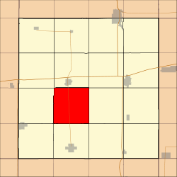 Location in Hancock County | |
| Coordinates: 43°02′26″N 93°47′38″W / 43.04056°N 93.79389°WCoordinates: 43°02′26″N 93°47′38″W / 43.04056°N 93.79389°W | |
| Country |
|
| State |
|
| County | Hancock |
| Area | |
| • Total | 36.37 sq mi (94.19 km2) |
| • Land | 36.37 sq mi (94.19 km2) |
| • Water | 0 sq mi (0 km2) 0% |
| Elevation | 1,188 ft (362 m) |
| Population (2000) | |
| • Total | 218 |
| • Density | 6/sq mi (2.3/km2) |
| Time zone | CST (UTC-6) |
| • Summer (DST) | CDT (UTC-5) |
| ZIP codes | 50423, 50447 |
| GNIS feature ID | 0467797 |
Erin Township is one of sixteen townships in Hancock County, Iowa, USA. As of the 2000 census its population was 218.[1]
History
Erin Township was organized in 1879.[2] It was originally settled chiefly by Irish immigrants, who named it Erin, the poetic form of Ireland.[3]
Geography
According to the United States Census Bureau, Erin Township covers an area of 36.37 square miles (94.19 square kilometers).
Adjacent townships
- Britt Township (north)
- Garfield Township (northeast)
- Liberty Township (east)
- Twin Lake Township (southeast)
- Amsterdam Township (south)
- Magor Township (southwest)
- Boone Township (west)
- Orthel Township (northwest)
Cemeteries
The township contains Saint Patrick's Cemetery.
Major highways
-
 Iowa Highway 111
School districts
- West Hancock Community School District
Political districts
- Iowa's 4th congressional district
- State House District 11
- State Senate District 6
References
- United States Census Bureau 2008 TIGER/Line Shapefiles
- United States Board on Geographic Names (GNIS)
- United States National Atlas
- ↑ United States Census Bureau American FactFinder
- ↑ History of Winnebago County and Hancock County, Iowa. Pioneer Publishing Company. 1917. p. 266.
- ↑ History of Kossuth, Hancock, and Winnebago Counties, Iowa. Union Publishing Company. 1884. p. 704.
External links
 |
Orthel Township | Britt Township | Garfield Township | |
| Boone Township | |
Liberty Township | ||
| ||||
| | ||||
| Magor Township | Amsterdam Township | Twin Lake Township |
Municipalities and communities of Hancock County, Iowa, United States | ||
|---|---|---|
| Cities | ||
| Townships | ||
| CDPs | ||
| Other unincorporated communities | ||
| Footnotes | ‡This populated place also has portions in an adjacent county or counties | |
This article is issued from Wikipedia - version of the 10/22/2016. The text is available under the Creative Commons Attribution/Share Alike but additional terms may apply for the media files.