Bünyan
| Bünyan | |
|---|---|
| Town | |
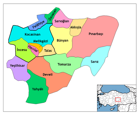 Location of Bünyan within Turkey. | |
 Bünyan Location of Bünyan within Turkey. | |
| Coordinates: TR 38°50′54″N 35°51′36″E / 38.8483°N 35.86°E | |
| Country |
|
| Region | Central Anatolia |
| Province | Kayseri |
| Government | |
| • Mayor | Mehmet Özmen (MHP) |
| Area[1] | |
| • District | 1,366.00 km2 (527.42 sq mi) |
| Population (2012)[2] | |
| • Urban | 11,866 |
| • District | 29,955 |
| • District density | 22/km2 (57/sq mi) |
| Time zone | EET (UTC+2) |
| • Summer (DST) | EEST (UTC+3) |
| Postal code | 38x xx |
| Licence plate | 38 |
| Website | www.bunyan.bel.tr |
Bünyan is a town and a district of Kayseri Province in Central Anatolia, Turkey. The town's former name was "Sarımsaklı", meaning "land of garlic" in reference to the region's considerable production of the Alliaceae plant, and this name is sometimes still used in the region.
As for the origins of the current name of "Bünyan", there are several theories.
The town is notable for its carpets (Bünyan carpet). One of the two Seljuk caravanserais named Sultan Han is located near Bünyan, as well as one of the several Danishmend mausoleums referred to as "Tomb of Melik Gazi", the one in Bünyan in fact having been built at a later period, by a bey of Dulkadirids. The town has a 1333-built Great Mosque, a legacy of the Ilkhanate rule in Anatolia, built by the Ilkhanate governor based here.
References
- ↑ "Area of regions (including lakes), km²". Regional Statistics Database. Turkish Statistical Institute. 2002. Retrieved 2013-03-05.
- ↑ "Population of province/district centers and towns/villages by districts - 2012". Address Based Population Registration System (ABPRS) Database. Turkish Statistical Institute. Retrieved 2013-02-27.