Basail Upazila
This article is about the Upazila. For the Union, see Basail Union.
| Basail বাসাইল | |
|---|---|
| Upazila | |
 Basail Location in Bangladesh | |
| Coordinates: 24°13′N 90°3′E / 24.217°N 90.050°ECoordinates: 24°13′N 90°3′E / 24.217°N 90.050°E | |
| Country |
|
| Division | Dhaka Division |
| District | Tangail District |
| Area | |
| • Total | 157.78 km2 (60.92 sq mi) |
| Population (2011) | |
| • Total | 159,870 |
| Time zone | BST (UTC+6) |
| Website | Official Website of Basail |
Basail (Bengali: বাসাইল) is an Upazila of Tangail District in the Division of Dhaka, Bangladesh.
Geography
Basail is located at 24°13′00″N 90°03′00″E / 24.2167°N 90.0500°E . It has 27481 households and total area 157.78 km².
Demographics
As of the 2011 Bangladesh census, Basail has a population of 159870. Males constitute 50.97% of the population, and females 49.03%. Basail has an average literacy rate of 50.4% (7+ years).[1]
Administration
Basail has 6 Unions/Wards, 73 Mauzas/Mahallas, and 107 villages.
The Union Parishads are-
Education
See also: Education in Bangladesh
According to Banglapedia, Basail Govinda Government High School, founded in 1945, is a notable secondary school.[2]
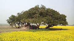
Pictures
 .
.  .
. 
See also
References
- ↑ "Population Census Wing, BBS.". Archived from the original on 2005-03-27. Retrieved November 10, 2006.
- ↑ Salim, Nurur Rahman (2012). "Basail Upazila". In Islam, Sirajul; Jamal, Ahmed A. Banglapedia: National Encyclopedia of Bangladesh (Second ed.). Asiatic Society of Bangladesh.
| Upazila/Thana: | ||
|---|---|---|

This article is issued from Wikipedia - version of the 11/10/2016. The text is available under the Creative Commons Attribution/Share Alike but additional terms may apply for the media files.