Kalkini Upazila
| Kalkini কালকিনি | |
|---|---|
| Upazila | |
 Kalkini Location in Bangladesh | |
| Coordinates: 23°4′N 90°14.5′E / 23.067°N 90.2417°ECoordinates: 23°4′N 90°14.5′E / 23.067°N 90.2417°E | |
| Country |
|
| Division | Dhaka Division |
| District | Madaripur District |
| Area | |
| • Total | 279.98 km2 (108.10 sq mi) |
| Population (1991) | |
| • Total | 250,916 |
| • Density | 900/km2 (2,300/sq mi) |
| Time zone | BST (UTC+6) |
| Website | Kalkini Upazila |
Kalkini (Bengali: কালকিনি) is an Upazila of Madaripur District in the Division of Dhaka, Bangladesh.[1]
Geography
Kalkini is located at 23°04′00″N 90°14′30″E / 23.0667°N 90.2417°E . It has 46314 households and total area 279.98 km².
Demographics
Fasiatala and Bazrusar of Banshgari union are the Great Village in Kalkini Upazila As of the 1991 Bangladesh census, Kalkini has a population of 250916. Males constitute 50.37% of the population, and females 49.63%. This Upazila's eighteen up population is 118534. Kalkini has an average literacy rate of 35.9% (7+ years), and the national average of 32.4% literate.[2]
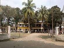
Points of interest
The main places of public interests in Madaripur are Senapati Dighi, Arial Khan River, kalkini syed abul hossain university college.
Administration
Kalkini has 1 powrashva 14 Unions, 161 Mauzas/Mahallas, and 190 villages. Kalkini has 1 (one) Upazila parishad and 2 police station.
- Kalkini police station
- Dasar police station
See also
References
- ↑ Rashimul Haq (2012), "Kalkini Upazila", in Sirajul Islam and Ahmed A. Jamal, Banglapedia: National Encyclopedia of Bangladesh (Second ed.), Asiatic Society of Bangladesh
- ↑ "Population Census Wing, BBS.". Archived from the original on 2005-03-27. Retrieved November 10, 2006.


| Upazila/Thana: | ||
|---|---|---|
