Kalihati Upazila
| Kalihati কালিহাতী | |
|---|---|
| Upazila | |
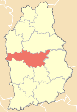 Location of Kalihati Upazila in Tangail District | |
 Kalihati Location in Bangladesh | |
| Coordinates: 24°23′N 90°0.5′E / 24.383°N 90.0083°ECoordinates: 24°23′N 90°0.5′E / 24.383°N 90.0083°E | |
| Country |
|
| Division | Dhaka Division |
| District | Tangail District |
| Area | |
| • Total | 301.22 km2 (116.30 sq mi) |
| Population (2011) | |
| • Total | 4,10,293 |
| • Density | 1,400/km2 (3,500/sq mi) |
| Time zone | BST (UTC+6) |
| Postal code | 1970 |
| Website | Official Map of Kalihati |
Kalihati (Bengali: কালিহাতী) is an Upazila of Tangail District,[1] Dhaka Division, Bangladesh.
History
It has a historical background during the liberation war in 1971.A great child of this land named Kader Siddiqui who later gained the great title "Bir Uttom" for his contribution for the war. After the liberation war he gave 32 trucks of weapons to the government. In the liberation period he formed a group named "Kaderia Bahini" with the brave bangalees. The "Kaderia Bahini" was very ferocious against the Pakistanis.
Geography
Kalihati is located at 24°23′00″N 90°00′30″E / 24.3833°N 90.0083°E . It has 65035 households and total area of 295.6 km².The upazila is surrounded by Bhuapur & Ghatail Upazila on the north, Tangail Sadar and Basail Upazila on the south, Sakhipur Upazila on the east, and the Jamuna River on the west.
Demographics
As of the 2011 Bangladesh census, Kalihati has a population of 4,10,293. Males constitute 51.55% of the population, and females 48.45%. Kalihati has an average literacy rate of 42.9% (7+ years).Male literary rate is 46.1% and female literary rate is 39.8 %.[2]
Administration
The Kalihati thana was established in 1928 and was turned into an upazila in 1983. The upazila consists of 2 municipalities, 14 union parishads, 248 mouzas, 298 villages.
The Union Parishads are-
- Balla Union
- Bangra Union
- Bir Bashinda Union
- Dashkia Union
- Durgapur Union
- Gohaliabari Union
- Kok Dohara Union
- Nagbari Union
- Narandia Union
- Paikara Union
- Parki Union
- Salla Union
- Sahadebpur Union
Education
- Bangabandhu Textile Engineering College
- Kalihati College
- Samsul Haque College
- Lutfor Rahman Motin Mohila College
Noble residents
- Dr. Debapriya Bhattacharya Econnomist,Distinguished Fellow at the Centre for Policy Dialogue(CPD).
- Manna Popular Actor,Producer.
See also
- Kalihati Town
- Tangail District
- Upazilas of Bangladesh
- Districts of Bangladesh
- Divisions of Bangladesh
References
- ↑ Shymal Chandra Nath (2012), "Kalihati Upazila", in Sirajul Islam and Ahmed A. Jamal, Banglapedia: National Encyclopedia of Bangladesh (Second ed.), Asiatic Society of Bangladesh
- ↑ "Population Census Wing, BBS.". Archived from the original on 2005-03-27. Retrieved November 10, 2006.
| Upazila/Thana: | ||
|---|---|---|
