Belle Fontaine, Alabama
| Belle Fontaine, Alabama | |
|---|---|
| Census-designated place (CDP) & Unincorporated community | |
 Belle Fontaine, Alabama  Belle Fontaine, Alabama | |
| Coordinates: 30°29′37″N 88°06′13″W / 30.49361°N 88.10361°W | |
| Country | United States |
| State | Alabama |
| County | Mobile |
| Area[1] | |
| • Total | 1.918 sq mi (4.97 km2) |
| • Land | 1.555 sq mi (4.03 km2) |
| • Water | 0.363 sq mi (0.94 km2) |
| Elevation | 7 ft (2 m) |
| Population (2010)[2] | |
| • Total | 608 |
| • Density | 320/sq mi (120/km2) |
| Time zone | Central (CST) (UTC-6) |
| • Summer (DST) | CDT (UTC-5) |
| Area code(s) | 251 |
| GNIS feature ID | 113875[3] |
Belle Fontaine (/ˌbɛl fɒnˈtɛn/; French: [bɛl fɔ̃ˈtɛn]) is an unincorporated community and census-designated place in Mobile County, Alabama, United States, on the western shore of Mobile Bay. It is located south of the city of Mobile, along the stretch of shore between Deer River and Fowl River. As of the 2010 census, its population was 608.[2]
The Belle Fontaine shoreline experiences the occasional jubilee, a rare phenomenon in which fish and crustaceans swarm in the water, just off the beach.
References
- ↑ "US Gazetteer files: 2010, 2000, and 1990". United States Census Bureau. 2011-02-12. Retrieved 2011-04-23.
- 1 2 "American FactFinder". United States Census Bureau. Archived from the original on 2013-09-11. Retrieved 2011-05-14.
- ↑ "Belle Fontaine". Geographic Names Information System. United States Geological Survey.
External links
- Location on Google Maps
Coordinates: 30°29′39″N 88°06′40″W / 30.49424°N 88.11121°W
Municipalities and communities of Mobile County, Alabama, United States | ||
|---|---|---|
| Cities | 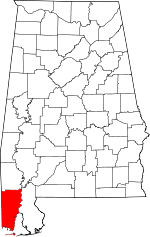 | |
| Towns | ||
| CDPs | ||
| Unincorporated communities | ||
| Ghost town | ||
| Footnotes | ‡This populated place also has portions in an adjacent county or counties | |
This article is issued from Wikipedia - version of the 11/8/2016. The text is available under the Creative Commons Attribution/Share Alike but additional terms may apply for the media files.