Bucks, Alabama
| Bucks, Alabama | |
|---|---|
| Census-designated place | |
 Bucks, Alabama | |
| Coordinates: 31°1′7.72″N 88°1′27.07″W / 31.0188111°N 88.0241861°W | |
| Country | United States |
| State | Alabama |
| County | Mobile |
| Area[1] | |
| • Total | 0.423 sq mi (1.10 km2) |
| • Land | 0.387 sq mi (1.00 km2) |
| • Water | 0.036 sq mi (0.09 km2) |
| Elevation | 49 ft (15 m) |
| Population (2010)[2] | |
| • Total | 32 |
| • Density | 76/sq mi (29/km2) |
| Time zone | Central (CST) (UTC-6) |
| • Summer (DST) | CDT (UTC-5) |
| ZIP code | 36512 |
| Area code(s) | 251 |
Bucks is an unincorporated community and census-designated place in Mobile County, Alabama, United States.[3] As of the 2010 census, its population was 32.[2] It is located in the northeastern section of the county near the Mobile River, along U.S. Route 43. The James M. Barry Electric Generating Plant, a coal- and natural gas-fired power station operated by Alabama Power, is located in Bucks.
Demographics
In 2010, Bucks had a population of 32. The racial and ethnic composition of the population was 59.4% white, 31.3% black or African American, 3.1% Native American, 6.3% from two or more races and 3.1% Hispanic or Latino of any race.[4]
Geography
Bucks is located at 31°1′7.72″N 88°1′27.07″W / 31.0188111°N 88.0241861°WCoordinates: 31°1′7.72″N 88°1′27.07″W / 31.0188111°N 88.0241861°W. The elevation is 49 feet (15 m).[3]
References
- ↑ "US Gazetteer files: 2010, 2000, and 1990". United States Census Bureau. 2011-02-12. Retrieved 2011-04-23.
- 1 2 "American FactFinder". United States Census Bureau. Archived from the original on 2013-09-11. Retrieved 2011-05-14.
- 1 2 "Bucks, Alabama". "Alabama Home Town Locator". Retrieved 2008-03-09.
- ↑ 2010 population by race and Hispanic or Latino by place report for Alabama from the US Census]
Municipalities and communities of Mobile County, Alabama, United States | ||
|---|---|---|
| Cities | 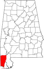 | |
| Towns | ||
| CDPs | ||
| Unincorporated communities | ||
| Ghost town | ||
| Footnotes | ‡This populated place also has portions in an adjacent county or counties | |