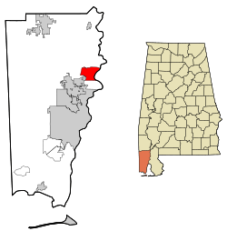
Creola, Alabama
| Creola | |
|---|---|
| City | |
 | |
| Coordinates: 30°53′43″N 88°0′53″W / 30.89528°N 88.01472°W | |
| Country | United States |
| State | Alabama |
| County | Mobile |
| Area | |
| • Total | 15.5 sq mi (40.1 km2) |
| • Land | 14.6 sq mi (37.8 km2) |
| • Water | 0.9 sq mi (2.3 km2) |
| Elevation | 23 ft (7 m) |
| Population (2000) | |
| • Total | 2,002 |
| • Density | 129.2/sq mi (49.9/km2) |
| Time zone | Central (CST) (UTC-6) |
| • Summer (DST) | CDT (UTC-5) |
| ZIP code | 36525 |
| Area code(s) | 251 |
| FIPS code | 01-18304 |
| GNIS feature ID | 0116848 |
| Website | http://www.cityofcreola.org |
Creola is a city[1] in Mobile County, Alabama, United States. The population was 1,926 as of the 2010 Census. This was down from 2,002 at the 2000 census, at which time it was still a town. It is included in the Mobile metropolitan statistical area. It incorporated in 1978.[2]
History
In 2013 the governments of Creola and Saraland were taking steps in a possible merger.[3]
Geography
Creola is located at 30°53′44″N 88°0′53″W / 30.89556°N 88.01472°W (30.895465, -88.014760).[4]
According to the U.S. Census Bureau, the town had a total area of 15.5 square miles (40 km2), of which 14.6 square miles (38 km2) is land and 0.9 square miles (2.3 km2) (5.62%) is water.
Demographics
| Historical population | |||
|---|---|---|---|
| Census | Pop. | %± | |
| 1970 | 472 | — | |
| 1980 | 1,652 | 250.0% | |
| 1990 | 1,896 | 14.8% | |
| 2000 | 2,002 | 5.6% | |
| 2010 | 1,926 | −3.8% | |
| Est. 2015 | 1,955 | [5] | 1.5% |
| U.S. Decennial Census[6] 2013 Estimate[7] | |||
As of the census[8] of 2000, there were 2,002 people, 718 households, and 567 families residing in the town. The population density was 137.1 people per square mile (52.9/km2). There were 796 housing units at an average density of 54.5 per square mile (21.0/km2). The racial makeup of the town was 86.36% White, 9.89% Black or African American, 1.45% Native American, 0.10% Asian, 0.35% from other races, and 1.85% from two or more races. 0.65% of the population were Hispanic or Latino of any race.
There were 718 households out of which 40.7% had children under the age of 18 living with them, 59.9% were married couples living together, 14.8% had a female householder with no husband present, and 20.9% were non-families. 17.1% of all households were made up of individuals and 5.8% had someone living alone who was 65 years of age or older. The average household size was 2.79 and the average family size was 3.15.
In the town the population was spread out with 29.2% under the age of 18, 9.6% from 18 to 24, 29.7% from 25 to 44, 22.3% from 45 to 64, and 9.2% who were 65 years of age or older. The median age was 34 years. For every 100 females there were 93.8 males. For every 100 females age 18 and over, there were 95.9 males.
The median income for a household in the town was $35,517, and the median income for a family was $38,942. Males had a median income of $35,658 versus $19,911 for females. The per capita income for the town was $14,956. About 14.3% of families and 16.0% of the population were below the poverty line, including 18.5% of those under age 18 and 19.9% of those age 65 or over.
2010 census
As of the census[9] of 2010, there were 1,926 people, 692 households, and 519 families residing in the town. The population density was 131.9 people per square mile (51.0/km2). There were 775 housing units at an average density of 53.1 per square mile (20.5/km2). The racial makeup of the town was 84.7% White, 9.8% Black or African American, 1.8% Native American, 0.1% Asian, 1.9% from other races, and 1.7% from two or more races. 3.1% of the population were Hispanic or Latino of any race.
There were 692 households out of which 34.0% had children under the age of 18 living with them, 55.3% were married couples living together, 12.9% had a female householder with no husband present, and 25.0% were non-families. 18.4% of all households were made up of individuals and 6.6% had someone living alone who was 65 years of age or older. The average household size was 2.78 and the average family size was 3.13.
In the town the population was spread out with 25.2% under the age of 18, 11.3% from 18 to 24, 26.1% from 25 to 44, 26.2% from 45 to 64, and 11.2% who were 65 years of age or older. The median age was 35.6 years. For every 100 females there were 108.2 males. For every 100 females age 18 and over, there were 110.7 males.
The median income for a household in the town was $41,786, and the median income for a family was $48,009. Males had a median income of $45,729 versus $36,902 for females. The per capita income for the town was $19,202. About 14.7% of families and 18.3% of the population were below the poverty line, including 29.1% of those under age 18 and 14.4% of those age 65 or over.
Education
Mobile County Public School System operates public schools. Students are zoned to North Mobile County K-8 School, previously North Mobile County Middle School,[10] in Axis. Creola students go to Citronelle High School in Citronelle.[11]
History of schools
On September 7, 2010, North Mobile County Middle School opened, replacing the role of Adams Middle School in Saraland, because residents outside of Saraland are no longer zoned to Adams Middle.[12] This rezoning affected residents in Creola, who were newly assigned to North Mobile County.[11]
Prior to the 2012 split of the City of Satsuma from the Mobile County system, Creola was zoned to Satsuma schools,[13] including Satsuma High School. In 2011 Renee Busbee of the Mobile Press-Register said that residents of Creola may be rezoned to Blount, Citronelle, and/or Vigor high schools.[14]
Ultimately Creola, without an elementary school after the departure of Satsuma schools, was rezoned to North Mobile County, converted into a K-8, and Citronelle High. Any Creola residents wishing to send their children to Satsuma schools would be required to pay tuition.[13] As of 2013 about 100 students residing in Creola attended Satsuma schools.[15]
Due to the distance to Citronelle High-the distance by bus is about 30 minutes-several area parents wanted an annexation to the City of Satsuma and/or a partnership with the Satsuma school system. In 2013 a member of the Creola city council, Tonya Moss, stated that the city has "a bond with Satsuma" and that most of the council's members had graduated from Satsuma High.[13] By 2013 there were discussions regarding a possible educational partnership between representatives of the two cities, in which the Creola city government would pay the City of Satsuma instead of Mobile County to educate its children.[15]
Transportation
Intercity bus service is provided by Greyhound Lines.[16]
References
- ↑ U.S. Census change list Archived August 6, 2010, at the Wayback Machine.
- ↑ "Creola voters reject proposal to merge with Saraland". Retrieved September 16, 2016.
- ↑ Ericson, Sally Pearsall. "Creola, Saraland leaders approve annexation proposal; now, it's up to the city councils to take next step." AL.com. September 5, 2013. Retrieved on July 30, 2016.
- ↑ "US Gazetteer files: 2010, 2000, and 1990". United States Census Bureau. 2011-02-12. Retrieved 2011-04-23.
- ↑ "Annual Estimates of the Resident Population for Incorporated Places: April 1, 2010 to July 1, 2015". Retrieved July 2, 2016.
- ↑ "U.S. Decennial Census". Census.gov. Archived from the original on May 11, 2015. Retrieved June 6, 2013.
- ↑ "Annual Estimates of the Resident Population: April 1, 2010 to July 1, 2013". Retrieved June 3, 2014.
- ↑ "American FactFinder". United States Census Bureau. Archived from the original on September 11, 2013. Retrieved 2008-01-31.
- ↑ "American FactFinder". United States Census Bureau. Archived from the original on September 11, 2013. Retrieved 2015-08-03.
- ↑ "Welcome to North Mobile County Middle School." North Mobile County Middle School. Retrieved on October 22, 2010. "The North Mobile County Middle School serves students living outside the Saraland City Limits and includes students from Satsuma, Creola, Axis, and Prichard. We will be located at the current Lee Intermediate Building and will be located here until a new facility is completed on Salco Road."
- 1 2 Ericson, Sally Pearsall. "North Mobile County K-8 offers high-tech learning (photos)." AL.com. September 11, 2013. Retrieved on July 29, 2016. "North Mobile County K-8, set in the heart of a beautiful pine forest, was built for students in Axis and Creola,[...]The Mobile County school system built North Mobile school,[...]to accommodate students displaced by Saraland's split from the school system."
- ↑ Phillips, Rena Havner. "Video: North Mobile County Middle School opens its doors in Axis". Mobile Press-Register. September 7, 2010. Retrieved on October 22, 2010. "North Mobile County Middle School students 6th grader Derrick Boykin, 12, and 7th grader Amanda Daniels, 12, walk down a sidewalk on the first day of classes at the school Tuesday, Sept. 7, 2010. The newly completed $14 million school was built to accommodate students displaced by Saraland's split from the Mobile County system."
- 1 2 3 Ericson, Sally Pearsall. "Creola ponders its future: 'This whole thing is about schools'." AL.com. August 25, 2013. Retrieved on July 29, 2016.
- ↑ Busbee, Renee. "Parents upset that children may not be able to attend Satsuma High School." Mobile Press-Register. Saturday May 21, 2011. Retrieved on November 17, 2012.
- 1 2 Ericson, Sally. "Property taxes a key issue in potential Satsuma-Creola schools partnership, attorney says." AL.com. August 21, 2013. Retrieved on July 29, 2016.
- ↑ Creola, AL Greyhound Station Intercity bus service
External links
Coordinates: 30°53′44″N 88°00′53″W / 30.895465°N 88.01476°W
Municipalities and communities of Mobile County, Alabama, United States | ||
|---|---|---|
| Cities | 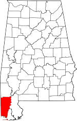 | |
| Towns | ||
| CDPs | ||
| Unincorporated communities | ||
| Ghost town | ||
| Footnotes | ‡This populated place also has portions in an adjacent county or counties | |