Fernland, Alabama
| Fernland, Alabama | |
|---|---|
| Unincorporated community | |
 Fernland, Alabama  Fernland, Alabama | |
| Coordinates: 30°29′00″N 88°17′35″W / 30.48333°N 88.29306°WCoordinates: 30°29′00″N 88°17′35″W / 30.48333°N 88.29306°W | |
| Country | United States |
| State | Alabama |
| County | Mobile |
| Elevation | 112 ft (34 m) |
| Time zone | Central (CST) (UTC-6) |
| • Summer (DST) | CDT (UTC-5) |
| Area code(s) | 251 |
| GNIS feature ID | 118262[1] |
Fernland is an unincorporated community in Mobile County, Alabama, United States. Fernland lies along U.S. Route 90 midway between the towns of Grand Bay to the west and St. Elmo to the east. The community originally formed around a sawmill[2] with its own post office and rail service.[3][4] During the days of segregation, elementary students attended Grand Bay Elementary School for Colored, which was located in the community. Current high school students attend Alma Bryant High School.
References
- ↑ "US Board on Geographic Names". United States Geological Survey. 2007-10-25. Retrieved 2008-01-31.
- ↑ See official state record noting formation of Fernland Saw Mill, online at http://arc-sos.state.al.us/cgi/corpdetail.mbr/detail?corp=742886&page=name&file=
- ↑ The Southern Reporter. West Publishing Company. 1892. pp. 242–.
- ↑ United States Civil Service Commission (1881). Official Register of the United States. U.S. Government Printing Office. pp. 362–.
Municipalities and communities of Mobile County, Alabama, United States | ||
|---|---|---|
| Cities | 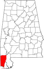 | |
| Towns | ||
| CDPs | ||
| Unincorporated communities | ||
| Ghost town | ||
| Footnotes | ‡This populated place also has portions in an adjacent county or counties | |
This article is issued from Wikipedia - version of the 10/28/2016. The text is available under the Creative Commons Attribution/Share Alike but additional terms may apply for the media files.