Blay
For people with the name Blay, see Blay (surname).
| Blay | |
|---|---|
|
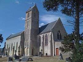
St. Pierre | |
 Blay | |
|
Location within Normandy region  Blay | |
| Coordinates: 49°16′14″N 0°50′22″W / 49.2706°N 0.8394°WCoordinates: 49°16′14″N 0°50′22″W / 49.2706°N 0.8394°W | |
| Country | France |
| Region | Normandy |
| Department | Calvados |
| Arrondissement | Bayeux |
| Canton | Trévières |
| Intercommunality | Trévières |
| Government | |
| • Mayor (2008–2014) | Damien Jumeau |
| Area1 | 7.14 km2 (2.76 sq mi) |
| Population (2008)2 | 332 |
| • Density | 46/km2 (120/sq mi) |
| Time zone | CET (UTC+1) |
| • Summer (DST) | CEST (UTC+2) |
| INSEE/Postal code | 14078 / 14400 |
| Elevation |
15–81 m (49–266 ft) (avg. 20 m or 66 ft) |
|
1 French Land Register data, which excludes lakes, ponds, glaciers > 1 km² (0.386 sq mi or 247 acres) and river estuaries. 2 Population without double counting: residents of multiple communes (e.g., students and military personnel) only counted once. | |
Blay (French pronunciation: [ble]) is a commune in the Calvados department in the Normandy region in northwestern France.
Population
| Historical population | ||
|---|---|---|
| Year | Pop. | ±% |
| 1962 | 236 | — |
| 1968 | 184 | −22.0% |
| 1975 | 217 | +17.9% |
| 1982 | 215 | −0.9% |
| 1990 | 239 | +11.2% |
| 1999 | 267 | +11.7% |
| 2008 | 332 | +24.3% |
See also
References
| Wikimedia Commons has media related to Blay. |
This article is issued from Wikipedia - version of the 3/16/2016. The text is available under the Creative Commons Attribution/Share Alike but additional terms may apply for the media files.