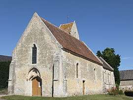
Fontaine-le-Pin
| Fontaine-le-Pin | ||
|---|---|---|
 | ||
| ||
 Fontaine-le-Pin | ||
|
Location within Normandy region  Fontaine-le-Pin | ||
| Coordinates: 48°58′28″N 0°16′56″W / 48.9744°N 0.2822°WCoordinates: 48°58′28″N 0°16′56″W / 48.9744°N 0.2822°W | ||
| Country | France | |
| Region | Normandy | |
| Department | Calvados | |
| Arrondissement | Caen | |
| Canton | Bretteville-sur-Laize | |
| Intercommunality | Pays de Falaise | |
| Government | ||
| • Mayor (2008–2014) | François Legrix | |
| Area1 | 8.54 km2 (3.30 sq mi) | |
| Population (2008)2 | 347 | |
| • Density | 41/km2 (110/sq mi) | |
| Time zone | CET (UTC+1) | |
| • Summer (DST) | CEST (UTC+2) | |
| INSEE/Postal code | 14276 / 14190 | |
| Elevation |
108–203 m (354–666 ft) (avg. 180 m or 590 ft) | |
|
1 French Land Register data, which excludes lakes, ponds, glaciers > 1 km² (0.386 sq mi or 247 acres) and river estuaries. 2 Population without double counting: residents of multiple communes (e.g., students and military personnel) only counted once. | ||

Fontaine-le-Pin is a commune in the Calvados department in the Normandy region in northwestern France.
Population
| Historical population | ||
|---|---|---|
| Year | Pop. | ±% |
| 1962 | 283 | — |
| 1968 | 258 | −8.8% |
| 1975 | 258 | +0.0% |
| 1982 | 289 | +12.0% |
| 1990 | 279 | −3.5% |
| 1999 | 284 | +1.8% |
| 2008 | 347 | +22.2% |
See also
References
| Wikimedia Commons has media related to Fontaine-le-Pin. |
This article is issued from Wikipedia - version of the 8/16/2016. The text is available under the Creative Commons Attribution/Share Alike but additional terms may apply for the media files.