Saint-Sever-Calvados
| Saint-Sever-Calvados | ||
|---|---|---|
 | ||
| ||
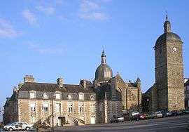
 Saint-Sever-Calvados | ||
|
Location within Normandy region  Saint-Sever-Calvados | ||
| Coordinates: 48°50′28″N 1°02′47″W / 48.8411°N 1.0464°WCoordinates: 48°50′28″N 1°02′47″W / 48.8411°N 1.0464°W | ||
| Country | France | |
| Region | Normandy | |
| Department | Calvados | |
| Arrondissement | Vire | |
| Canton | Saint-Sever-Calvados | |
| Intercommunality | Séverine | |
| Government | ||
| • Mayor (2008–2014) | Jean-Pierre Nourry | |
| Area1 | 27.92 km2 (10.78 sq mi) | |
| Population (2008)2 | 1,369 | |
| • Density | 49/km2 (130/sq mi) | |
| Time zone | CET (UTC+1) | |
| • Summer (DST) | CEST (UTC+2) | |
| INSEE/Postal code | 14658 / 14380 | |
| Elevation |
144–350 m (472–1,148 ft) (avg. 243 m or 797 ft) | |
|
1 French Land Register data, which excludes lakes, ponds, glaciers > 1 km² (0.386 sq mi or 247 acres) and river estuaries. 2 Population without double counting: residents of multiple communes (e.g., students and military personnel) only counted once. | ||
.svg.png)
Saint-Sever-Calvados is a commune in the Calvados department in the Normandy region in northwestern France.
Population
| Historical population | ||
|---|---|---|
| Year | Pop. | ±% |
| 1793 | 1,539 | — |
| 1800 | 1,527 | −0.8% |
| 1806 | 1,512 | −1.0% |
| 1821 | 1,515 | +0.2% |
| 1831 | 1,653 | +9.1% |
| 1836 | 1,685 | +1.9% |
| 1841 | 1,658 | −1.6% |
| 1846 | 1,608 | −3.0% |
| 1851 | 1,630 | +1.4% |
| 1856 | 1,551 | −4.8% |
| 1861 | 1,507 | −2.8% |
| 1866 | 1,517 | +0.7% |
| 1872 | 1,526 | +0.6% |
| 1876 | 1,540 | +0.9% |
| 1881 | 1,554 | +0.9% |
| 1886 | 1,514 | −2.6% |
| 1891 | 1,512 | −0.1% |
| 1896 | 1,338 | −11.5% |
| 1901 | 1,387 | +3.7% |
| 1906 | 1,456 | +5.0% |
| 1911 | 1,472 | +1.1% |
| 1921 | 1,335 | −9.3% |
| 1926 | 1,400 | +4.9% |
| 1931 | 1,539 | +9.9% |
| 1936 | 1,704 | +10.7% |
| 1946 | 1,680 | −1.4% |
| 1954 | 1,566 | −6.8% |
| 1962 | 1,485 | −5.2% |
| 1968 | 1,415 | −4.7% |
| 1975 | 1,379 | −2.5% |
| 1982 | 1,425 | +3.3% |
| 1990 | 1,409 | −1.1% |
| 1999 | 1,325 | −6.0% |
| 2008 | 1,369 | +3.3% |
International relations
The commune is twinned with:
- Niederdorfelden, Germany since 1973.
See also
- Communes of the Calvados department
- History of Saint Sever and the religious community he started in the forest - with images
References
| Wikimedia Commons has media related to Saint-Sever-Calvados. |
This article is issued from Wikipedia - version of the 3/19/2016. The text is available under the Creative Commons Attribution/Share Alike but additional terms may apply for the media files.