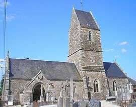
Campagnolles
| Campagnolles | |
|---|---|
 | |
 Campagnolles | |
|
Location within Normandy region  Campagnolles | |
| Coordinates: 48°53′27″N 0°55′26″W / 48.8908°N 0.9239°WCoordinates: 48°53′27″N 0°55′26″W / 48.8908°N 0.9239°W | |
| Country | France |
| Region | Normandy |
| Department | Calvados |
| Arrondissement | Vire |
| Canton | Saint-Sever-Calvados |
| Intercommunality | Séverine |
| Government | |
| • Mayor (2008–2014) | Catherine Gournay-Leconte |
| Area1 | 10.06 km2 (3.88 sq mi) |
| Population (2008)2 | 448 |
| • Density | 45/km2 (120/sq mi) |
| Time zone | CET (UTC+1) |
| • Summer (DST) | CEST (UTC+2) |
| INSEE/Postal code | 14127 / 14500 |
| Elevation |
95–164 m (312–538 ft) (avg. 140 m or 460 ft) |
|
1 French Land Register data, which excludes lakes, ponds, glaciers > 1 km² (0.386 sq mi or 247 acres) and river estuaries. 2 Population without double counting: residents of multiple communes (e.g., students and military personnel) only counted once. | |
Campagnolles is a commune in the Calvados department in the Normandy region in northwestern France.
Population
| Historical population | ||
|---|---|---|
| Year | Pop. | ±% |
| 1962 | 354 | — |
| 1968 | 361 | +2.0% |
| 1975 | 361 | +0.0% |
| 1982 | 364 | +0.8% |
| 1990 | 417 | +14.6% |
| 1999 | 392 | −6.0% |
| 2008 | 448 | +14.3% |
See also
References
| Wikimedia Commons has media related to Campagnolles. |
This article is issued from Wikipedia - version of the 10/8/2016. The text is available under the Creative Commons Attribution/Share Alike but additional terms may apply for the media files.